Quite a while back, as the North American continental landmass moved westward across the face of the earth, it overrode a section of the oceanic rift system. This section of the oceanic rift system then ended up beneath the western part of the landmass. After this happened, it appears that Baja California was "captured" by the Pacific Plate which resides on the western side of this rift system. This "sliver" of land was then ripped loose from the mainland of Mexico (link). Baja was then shifted approximately 300 miles north, forcing strongly against other sections of the North American landmass, during its northward travel.
At this point, it appears that Baja California and those portions of of the state of California which reside to the west of the San Andreas fault are more firmly "captured" by the northwesterly moving Pacific Plate. And, to the east of the San Andreas fault, it appears that California is similar to a "train wreck" of "loose" microplates which are not so firmly captured by the northwesterly moving Pacific Plate. One of the California microplates caught in this geologic "train wreck" is the Sierra Nevada-Great Valley microplate (link).
A 2013 page linked here states that "the heart of California -- the Central Valley and the mountains that ring it -- is a separate tectonic plate, bounded by fault zones all the way around. The Sierra Nevada microplate rotates slightly and moves northwest at a few millimeters per year relative to the rest of the North America plate." The page speaks of "the other side of the Sierra Nevada microplate [to the east of the Sierra Nevada], where the Earth's outer shell is secretly splitting apart." But, what is actually happening in that area to the east of the Sierra Nevada?
To understand what is happening to the east of the Sierra Nevada, we must once again look to that section of the oceanic rift which ended up beneath the landmass of western North America, in earlier times. To decipher where this section of oceanic rift lies deep beneath the continental landmass, we must look for a string of sites where there is thermal and volcanic activity which is of a nature that is similar to that which commonly occurs along the worldwide, mid-oceanic ridge and rift system (1)(2)(3)(4).
To the east of the Sierra Nevada is the northwesterly-trending Walker Lane. A document linked here is titled Siting of Large Volcanic Centers at Releasing Fault Stepovers, Walker Lane Rift. On PDF page 5 of 54, the document declares that the Walker Lane Belt "has the structure that is the most similar to Gulf of California transtensional rift basins..." Why is this? Possibly it is this way because the Walker Lane is actually where the northern extension of the oceanic rift from the bottom of the Gulf of California truly lies beneath the continental landmass.
At this point, there is something to clearly note. The San Andreas fault does not appear to mark the true path of the oceanic rift which resides deep beneath the continental landmass in California. In the geologic "trainwreck" of California, the San Andreas fault is related to the rifting, but it is something else altogether. The true rift appears to be further to the east.
To help identify the different nature of the San Andreas fault, along its path it should be observed that it is missing that large amount of volcanic activity with is common to the worldwide oceanic rift system. But, to the east of the Sierra Nevada, there is "the structure that is the most similar to Gulf of California transtensional rift basins," with volcanic activity and all.
As noted in the title of that document linked a couple of paragraphs above, the Walker Lane is a rift. It is the area in California where the continental landmass is pulling apart or breaking up (1)(2). Because the continental landmass is pulling apart in this area, there are found here those geologic features known as "grabens" or central rift valleys (1)(2)(3)(4)(5). And, because of the continental rifting in this area, the Walker Lane is a geologic trough (1)(2)(3)(4)(5)(6). A geologic trough is an area where the structure of the landmass has sunk down for some distance in a linear feature. But, there is more to this story.
At its northern end, the Walker Lane joins into the southern end of the Cascade Mountains, which is that line of mighty volcanoes. And, there is something important to note about this line of volcanoes. At the southern, California end of the Cascade Range, there is the volcano known as Lassen Peak (link). But Lassen Peak is not in line with the other volcanoes of the Cascade Range. Lassen Peak is on a "dogleg," where the Cascade Range sharply bends to the southeast. Why is this? Possibly it is because the Cascade Range is associated with that rift system buried deep beneath the Walker Lane, where things are pulling apart (1). It appears that the Cascades are part of the volcanic features related to that section of oceanic rift which is buried deep beneath the continental landmass in the western part of North America.
It appears that the Walker Lane shows the surface effects of the deeply buried section of the oceanic rift system, especially with its volcanoes and other thermal features. There is something else to now consider. A page linked here indicates that "rifts in the interior of continents" last for a while "before complete rupture of the continent and onset of sea-floor spreading." Once the massive earthquakes begin, as the rift affecting the area to the east of the Sierra Nevada starts spreading in earnest, it appears that the Gulf of California will begin to extend further and further north. As this major geologic activity continues, California will be separated further and further from the United States. But, again, there is more to this story.
There is that dogleg in the southern Cascade Range, which was noted above, where the Cascades join into the Walker Lane and its associated rift system and volcanic features (1)(2)(3). It appears that the Cascade Range, with its volcanoes and hot springs, is also the surface effect of that section of oceanic rift system which is buried deep beneath the continental landmass. At this point, there is something to once again note.
Because of the spreading on the rift system buried far below, the landmass in the Walker Lane has sunk down and formed into a geologic trough (link). Within this trough are a number of geologic features known as grabens. And now, let us continue onward. To the north, in the Cascade Range, there is also a graben. This graben in the Cascade Range indicates that this volcanic mountain range may actually mark the location of that spreading oceanic rift, which is buried deep beneath the continental landmass.
There are some things to note about the zone of spreading in the Cascade Mountains. A link here accesses a portion of a document titled Oregon Geology. On PDF page 3 of 32, the document speaks of the "High Cascade trough or graben, which extends most of the length of the state [of Oregon]." It indicates that this graben and its associated faults represents "crustal failure on a grand scale." It appears that it is crustal failure on a grand scale because the landmass above is being strongly affected by that active section of oceanic rift which is buried deep beneath the continental landmass.
There is now something even more revealing to note about this trough or graben in the High Cascades. In the lower-right portion of PDF page 13 of 32, in the document linked in the paragraph above, it notes that the High Cascades graben is "associated with extensional tectonics." On PDF page 14 of 32, the document speaks about this High Cascades graben "opening like a zipper from the south." In the south, the graben has subsided "as deep as two miles," while further north in the central portion of this graben, the landmass has subsided "less than a mile."
In the paragraph above, when is speaks about the High Cascades graben being "associated with extensional tectonics" and also "opening like a zipper from the south," there is something to think about. It appears that there may be some association with that separation of the landmass which initially formed the Gulf of California. Possibly in the future, as things progress, the Gulf of California could extend much further north. And now, there is something else to note.
On PDF page 14 of 32 in the document linked above, when it comes to the High Cascades graben, it declares: "Lavas, emerging with the rifting, closely resemble mid-ocean ridge basalts (MORB)." Now, why would this be? Well, once again, it possibly has something to do with that section of the oceanic rift system which is now buried deep beneath the continental landmass. And, that buried section of oceanic rift system would naturally be discharging lavas which "closely resemble mid-ocean ridge basalts (MORB)."
At this point, there are some who are wondering if the typical Cascadia Subduction Zone models (1)(2)(3) may not be completely accurate. Possibly they are not properly portraying what is actually happening in the Cascadia region of North America. In reality, it appears that the Cascadia region may be dealing with something just a bit different than simply a subduction zone, especially when things appear to be "unzipping" from the south to the north along a line which includes the Gulf of California, the Walker Lane to the east of the Sierra Nevada, and the graben in the High Cascades of Oregon.
Possibly there could be some unexpected things happening in the Cascadia region in the times ahead, especially if that geologic "zipper" decides to unzip even further. So, there are now some things to think about. A few things which could possibly stand between those who reside in the western coastal regions of North America and a very wild geologic ride could potentially be the resistance caused by the embedded Klamath Mountains and, looking further to the north, the embedded Olympic Mountains. But, once the "resistance" now holding things in place is overcome, as the Pacific Plate continues in its northerly travel, it may than be time to really "hang on to your hat."
In closing, there are some words of wisdom for the scientists, with their high-tech computerized earthquake models and all. In more recent times, they have been getting horrendously blindsided by the nature and magnitude of large earthquake events. So, let us look back to Ralph Waldo Emerson, of earlier times. In his wisdom, Emerson declared: "We learn geology the morning after the earthquake, on ghastly diagrams of cloven mountains, upheaved plains, and the dry bed of the sea."(1)(2)(3) What is potentially coming to the West Coast region of North America may have to be seen, in order to be believed.
For further reading:
Current Expectations for a Cascadia Mega-Quake
https://cascadian.neocities.org/cascadiaquake.htm
The Greatest Earthquake Ever Felt
http://ourworld.freevar.com/greatestearthquake.htm
Saturday, December 8, 2018
A Zone of Continental Rifting ?

Thursday, June 21, 2018
Rapid Emplacement of the Columbia Lava Plateau ?
It is time for some serious "food for thought." In this blog, back in September 27, of 2016, there was an entry made which is titled Concealed Faults and Rifts in the Pacific Northwest (link). There is something mentioned in that entry which now, because of a real life example, needs to be looked at more closely. It is time to consider the speed at which the layers of igneous or magmatic rock were formed in the Columbia Lava Plateau, which covered a large portion of what is now Washington and Oregon, plus a portion of Idaho.
About half way down in the blog entry linked above, two sources are noted which state two different flow rates for the lava which spread out over the surrounding countryside and formed the Columbia Lava Plateau. The first source, which is linked here, declares the following:
"It is believed that the fronts of the lava flows were several stories (approximately 30 meters) high as they flowed from the eruption center at speeds up to three miles per hour (Alt and Hyndman, 1985). These basalts erupted from long fissures in the ground, not from volcanic cones."
The second source, a page linked here from the Western Oregon University (WOU) site, on PDF page 3 of 19, regarding the Columbia Plateau, speaks about "the basalts that flooded this province." The page speaks about "an output per flow of over 100 cubic miles of basalt." But then it states: "Larger eruptions, however, encompass over 500 cubic miles of basalt for a single flow."
The WOU page speaks of the speed of the flow, with these words: "Thick, successive outpourings of lava spread over the landscape often moving at a speed of up to 30 miles an hour to form the Columbia River basalts, the primary group in the plateau today." The page then goes on to speak about the total volume of basalt in the lava plateau, which is stated at "over 42,000 cubic miles, [which] would be enough to construct a wall of lava one mile wide and almost 2 miles high around the earth."
Okay, so we are speaking about a whole lot of basaltic lava in the Columbia Lava Plateau. The evidence indicates that this basaltic lava came gushing or rapidly flooding out of immense cracks in the ground at an incredible rate. But, the first source indicates that the front of the spreading lava flows moved away from the eruption center "at speeds up to three miles per hour." The second source, from Western Oregon University, states that "thick, successive outpourings of lava spread over the landscape often moving at a speed of up to 30 miles an hour..."
Looking at the information above, there is something which needs to be clarified. We see that there are two very different speed ranges given for how fast the basaltic lava spread out in the Columbia Plateau region. Once again, the first source states that the lava moved "at speeds up to three miles per hour," and the second source states that this lava was "often moving at a speed of up to 30 miles an hour." So, which one of these two rates is the most realistic, when considering all the evidence?
There is a reason to want to know the truth about how fast this lava can move. With a lava flow moving at three miles per hour, a person could potentially get out of the way of the lava flow. But, with a flow rate of 30 miles per hour, there would have been no chance for a human to outrun this flow, if any human would have been present to see this incredible geologic event. So, is it possible that this basaltic lava in the Columbia Plateau could have moved at speeds near 30 miles per hour, as the plateau was forming?
The Columbia Lava Plateau was formed by "flood basalts." (link) When these "flood basalts" erupt from the ground, "a lot of easy flowing, highly fluid basaltic lava can pour out of the fissure all at once." (link) A source, linked here, declares that flood basalts spread "out across the land like water in a flood."
Now, once again very clearly: these flood basalts, like those which created the Columbia Lava Plateau, are known to flow across the countryside like water. So, are there any examples from our present day which can potentially indicate just how fast this type of lava can flow. What about that which is currently happening (in June 2018) in the U.S. state of Hawaii? Well, let us look at a few examples.
A page linked here speaks about "Kilauea's Rivers of Fire and Lava." Yes, at first this volcano was putting out lava which slowly oozed across the land, as it slowly destroyed things. But then things changed. The lava then became more fluid and began to flow like water, yes, like water in a rushing river.
Getting back to the Cascadia region, the WOU page spoke about the basaltic lava in the Columbia Plateau region "often moving at a speed of up to 30 miles an hour." Let us see, in the videos linked below about the lava in Hawaii, how fluid this lava can be while it is still in the ground and then what it can look like as it flows across the land. And, this is just in a small area or in just a rather confined river of fire.
Now, imagine this lava, but in very thick layers as it was in the Cascadia region, gushing out of the ground, layer after layer, and flooding in all directions across the countryside. Let us imagine this happening at a rather high rate of speed. Welcome to the forming Columbia Lava Plateau. And yes, history has shown that those types of things which have happened before on this earth can definitely happen again. That may, at least to a degree, go along with the saying: "History repeats itself."
Now it is time to educate ourselves about what flowing lava can look like, plus what it can do. Just check out the videos below and realize that this particular geologic event in Hawaii is showing only a rather "small scale" event upon this earth.
EDUCATIONAL VIDEOS --- "The Lake of Fire":
Video Inside Halemaumau Lava Lake Dropped 240 Yards [video time - 0:39]
https://www.youtube.com/watch?v=cl-QvtvsKr4
Drones Sacrificed for Spectacular Volcano Video [video time - 3:30]
https://www.youtube.com/watch?v=zFIWWM0Iv-U
Lava surfaces in Kilauea volcano crater, Hawaii [video time - 0:41]
https://www.youtube.com/watch?v=X2SnEY0WhwU
EDUCATIONAL VIDEOS --- "The Coming Out":
Aerial footage Kilauea eruption in Hawaii (June 11, 2018) [video time - 10:14]
https://www.youtube.com/watch?v=mcBQKX1ivUs
Kilauea erupts again [video time - 1:58]
https://www.youtube.com/watch?v=PFzNxNrqd-c
Lava from...Kilauea volcano lit up the night on Tuesday (May 22) [video time - 1:36]
https://www.youtube.com/watch?v=lMSRe2oqnzU
Raw Video: Lava Bursts from New Fissure on Kilauea Flank [video time - 1:32]
https://www.youtube.com/watch?v=jDZ9sLN_8c4
New fissures open, lava becomes more fluid in Leilani Estates [video time - 5:00]
https://www.youtube.com/watch?v=cTcWo6n6V74
Hawaii Update/500' Lava Fountain/Approaching Geothermal Plant [video time - 8:10]
https://www.youtube.com/watch?v=I1cM8Cvd9SU
Red Lava Rivers From Hawaii's Kilauea Volcano - Aerial Views [video time - 1:40]
https://www.youtube.com/watch?v=MG84-mSrXqo
Destructive lava flows in Hawaii (June 8, 2018) [video time - 11:08]
https://www.youtube.com/watch?v=JLVdTX4pu4E
Hawaii's Lava Flow Is a Mesmerizing Force [video time - 6:36]
https://www.youtube.com/watch?v=_hyE2NO7HnU
River of Fire - Mesmerizing Hawaii Lava Timelapse 4K [video time - 2:57]
https://www.youtube.com/watch?v=CX8DSLWv0C8
EDUCATIONAL VIDEO --- "Just a Fast Flowing Stream":
Lava River Flowing From Tube Kilauea Volcano Hawaii [video time - 0:25]
https://www.youtube.com/watch?v=LdCoGOumKe4
EDUCATIONAL VIDEOS --- "The Rushing, Fiery Flood":
Hawaii Volcano Eruption Update - Tuesday Morning (June 19, 2018) [video time - 2:41]
https://www.youtube.com/watch?v=NabumrEDpkA
Amazing Lava Flows in Hawaii (June 15, 2018) [video time - 12:34]
https://www.youtube.com/watch?v=PQAxaQVpxtY
New Lava Flow in Hawaii (June 17, 2018) [video time - 10:14]
https://www.youtube.com/watch?v=1BPdGC0dcMc
Beautiful Lava River in Hawaii (JUNE 18, 2018) [video time - 12:02]
https://www.youtube.com/watch?v=RDalQKbn_Ko
BASIC TRUTHS and SOME QUESTIONS:
When the fiery basaltic magma rapidly spreads across the land in virtually all directions, as it did when the Columbia Lava Plateau was formed, if a person were there, they could run, but they could never hide from the fast-moving destruction. Now for some questions.
Is there any chance that a massive Cascadia earthquake event could be associated with major, deep cracking and movement in the groundmass? Is there any chance that basaltic lava could once again gush out of the earth and flow across the land and cover a large portion of that which is now Washington, or Oregon, or even Idaho?
Once again, as a point of reference, that which is happening in Hawaii is just "small scale stuff." The geologic history of the Cascadia region has shown what "large scale stuff" actually looks like! So, to those in the Cascadia region, do you think you can handle the "large scale stuff" when it actually happens?
A NOTE:
By the majority upon this earth, the information presented above may be considered as a good stopping point in your reading. But for the few, there may be some further things to consider.
AN OLD WRITING:
Now, but only for those who would like to consider life further or for those who would like a deeper understanding of things upon this earth, it is time for some real "food for thought."A long time ago, there were instructions given to a certain group of people. There were many things which they were clearly told that they were not to be doing. Then the set of instructions declared:
"Defile not ye yourselves in any of these things: for in all these the nations are defiled which I cast out before you: and the land is defiled: therefore I do visit the iniquity thereof upon it, and the land itself vomiteth out her inhabitants." (link1) (link2) (link3)
SOME FURTHER QUESTIONS:
Could flood basalts rapidly flowing across and covering portions of the region now occupied by Washington, Oregon and Idaho be a good example of the land "vomiting something out"...vomiting something out from immense cracks in the ground?
Is there any possibility that major geologic events which have happened before on this earth could happen again, maybe even at a different or larger scale? If an event similar to the formation of the Columbia Lava Plateau were to happen again, would the land, in effect, be vomiting out the inhabitants thereof?
And then, but only for those who want a deeper understanding of things, when considering these molten or fiery things, there is that thing which is called the Lake of Fire. (link) Is there any way that it could fit into a discussion about fiery geologic events which can happen upon this earth?
THE PORTLAND METRO AREA:
As we watch the volcanic things which have recently been happening in Hawaii, there may be some things for those in the Cascadia region to consider, especially for those living in Portland, Oregon.
Portland is built in the Boring Lava Field. (link) According to the linked source, there are "at least 32 cinder cones and small shield volcanoes lying within a radius of 13 miles (21 km) of Kelly Butte, which is approximately 4 miles (6 km) east of downtown Portland, Oregon, in the United States."
It appears that at some earlier point in history, the Portland region was "bubbling and smoking" all over with volcanic activity. For those who have seriously studied geology, some have come to the conclusion that volcanoes and their "offspring" may become dormant, but it appears that a volcano or volcanic vent from the past cannot necessarily be guaranteed as being extinct.
It does appear that there may be more to this story about volcanic activity in the Portland area than just the "32 cinder cones and small shield volcanoes" noted above. In the Portland area, there are at least 95 lava vents. These vents are found in the West Hills of Portland and in areas southward and eastward from there, plus even up into Washington. These volcanic features are noted on a map which is linked here.
The Portland metro area has a large population. If volcanic activity were to ever "awaken" in the Portland region, many residents could be negatively affected. So possibly a question should be asked. How would Portland respond if a Hawaii type of event, or something even larger, were to occur in the local area?
For further reading:
Current Expectations for a Cascadia Mega-Quake
https://cascadian.neocities.org/cascadiaquake.htm
Wednesday, May 9, 2018
The Real CALEXIT Separation from the United States ?
The occasional blogger now enters cyberspace to make another post. It is time for some real "food for thought," with a different twist.
For a period of time, there has been that Calexit movement, in which a certain segment of people in California want to be separated from the United States. The occasional blogger now poses some questions.
Will the state of California be separated from the United States in a far different manner than the Calexit group is hoping for? Will California physically be separated from the United States via that major rift zone which extends northward from the northern end of the Gulf of California? Will California be physically separated from the United States, in the area of that rift zone which lies to the east of the Sierra Nevada and extends all the way to the Oregon border and beyond?
The major rift zone to the east of the Sierra Nevada is noted in earlier posts in this blog, plus in the page linked below titled Current Expectations for a Cascadia Mega-Quake.
Before the idea of California being ripped loose from the landmass of the United States is discounted, let it be noted that Baja California, in earlier times, was ripped loose from the mainland of Mexico and then shifted hundreds of miles to the northwest. This movement created the Gulf of California. At this point, there is something to seriously consider.
If California were to become physically separated from the United States along the generally northwest-southeast aligned rift zone, that could mean massive, world-class earthquakes. Such an event could leave California utterly devastated, with a lot of destroyed structures and infrastructure.
This form of Calexit would possibly not be the best way to start a new country...with devastated infrastructure and a devastated economy, plus a decimated populace.
For further reading:
Current Expectations for a Cascadia Mega-Quake
https://cascadian.neocities.org/cascadiaquake.htm
Saturday, February 10, 2018
The New Pacific Northwest Look ... After the Megaquake
It is time for the occasional blogger to once again poke his head into cyberspace. Seeing the various quakes which have been happening since the last post, about 4-1/2 months ago on Saturday, September 30, 2018, it is time to make a few comments.
On Tuesday, February 6, 2018, an M6.4 quake struck off the east coast of Taiwan. An image, linked here, shows one of the buildings in Taiwan which got tilted over a bit. A page, linked here, gives some information about this quake. Once again, this was a quake with a magnitude of only 6.4, which tipped this building at such and angle.
Linked here is another picture of that building in Taiwan, which is tilting greatly. Just think what it may have been like to be in that building. And again, that happened with only an M6.4 quake.
On Saturday, February 6, 2016, a different M6.4 struck Taiwan. This time the quake struck about 30 miles east of the city of Tainan, which has a population of about 2 million people. A picture, linked here, shows a couple of more buildings which tipped over, plus a lot of damage. A page, linked here, tells what happened. And, once again, all this happened with just an M6.4 quake.
Let's now look at what happened during the Great Tangshan Earthquake in China, on July 28, 1976. This quake had a magnitude of 7.8 and killed at least 242,000 people, which was the official claimed death toll (link), but other estimates have the death toll as high as 650,000 people (link). Accessed here, here, here, here, here, and here, are pictures of damage which occurred during this quake.
A 7.8 magnitude earthquake, when using the USGS earthquake comparison calculator, linked here, is found to be about 25 times bigger than the 6.4 magnitude quake, but it is almost 126 times stronger in the energy released. So, take another look at the pictures and see the difference in damage resulting from these two different sized quakes.
Now that we are looking at comparisons, there is something to consider. The quake which is expected in the Cascadia region of North America --- in the Pacific Northwest of the United States and the adjoining part of British Columbia, Canada --- may have a magnitude of 9.2 or potentially a bit more. So, it is time to take a look at something.
Using the USGS earthquake comparison calculator once again, a magnitude 9.2 quake is about 25 times bigger than a magnitude 7.8 quake, like that which struck Tangshan, China, in 1976. But, a 9.2 quake is about 126 times stronger in the energy released, compared to that released by a magnitude 7.8 quake.
It is time for a bit of Reality 101. Once again, take a good look at those pictures linked above, which compare the two different size quakes and the resulting damage.
Now, take those Tangshan pictures, from the M7.8 quake, and imagine in your mind devastation at a much greater scale, from a quake which is 25 times larger in ground motion and 126 times stronger in the energy released.
Now, consider that which appears to be in the future for the Cascadia region of North America. Have you started to prepare yourself for something like this? If you haven't yet, now is the time to start.
Yes, it is true that things can be different at different locations. There are many factors involved when it comes to how much damage will result at any given location. But nevertheless, a magnitude 9.2 or larger quake can potentially make quite a mess of things in the Cascadia region. So, now it the time to start preparing. Tomorrow...
For further reading:
Current Expectations for a Cascadia Mega-Quake
https://cascadian.neocities.org/cascadiaquake.htm
Saturday, September 30, 2017
The Grand Collision -- Part 1 -- Initiation of Movement
This is the beginning of a multi-post series which should help to explain a very important, grand collision which it appears the North American continent experienced in earlier times. This collision appears to have occurred during the westward movement of the continent across the face of the earth. Understanding this specific grand collision should help to better understand what is being dealt with today, geologically, in western North America, plus how it relates to the fast approaching Cascadia earthquake event.
There have been theories over time about how the continents move and have moved across the face of the earth. One early theory was called "continental drift" (1) (2) (3). Later, the theory of continental drift was largely replaced by the theory of plate tectonics (4). But, in all of this, a question should possibly be asked. What initiated all this movement of the continents?
A page, linked here, contains the following statement: "All the rocky planets in our solar system -- Mercury, Venus, Earth and Mars -- have the same internal structure. But only Earth's crust shows signs of plate motion." According to researchers noted in the article, "something [had] to destabilise the crust." Something had to fracture the crust into pieces which could then allow for setting the plates into motion. The researchers believe that it was a massive asteroid impact which broke up the crust of the earth and initiated the movement of the continents.
Further pages, which include information about an impactor or impactors from space potentially moving continents, are accessed via the following links: (5) (6) (7) (8) (9) (10) (11) (12) (13)
Now, looking to our day, a page, linked here, states that "astronomers are discovering more and more large asteroids that could one day collide with Earth. The planet, says Dr. Eugene M. Shoemaker of the United States Geological Survey, 'resides in an asteroid swarm.'" The page states further: "Experts also say that further asteroid or comet collisions with Earth must be expected because the number of asteroids discovered in orbits that cross or come near that of Earth is increasing rapidly." So, what could these collisions or impacts have upon the face of the earth?
For a moment, let us consider impactors from space causing movement of physical features on the surface of the earth. A prophecy in a historic document contains the following words: "And I beheld when he had opened the sixth seal, and, lo, there was a great earthquake; and the sun became black as sackcloth of hair, and the moon became as blood; and the stars of heaven fell unto the earth, even as a fig tree casteth her untimely figs, when she is shaken of a mighty wind. And the heaven departed as a scroll when it is rolled together; and every mountain and island were moved out of their places."(link)
After considering all the information presented or linked above, it is possibly reasonable to believe that impactors from space could have initiated movement of the landmasses upon the face of this earth. It is also reasonable to believe that large impactors from space, with their associated force, could cause sudden and relatively fast movement of the affected landmasses. With these considerations in mind, let us now prepare move onward.
The next post in this series will examine a specific portion of the "grand collision" which it appears the North American continent experienced in earlier times, after it was sent on is westward voyage. This grand collision appears to have set the stage for a massive Cascadia earthquake event --- one which we may see in our lifetimes.
NOTE: As important information comes to the
attention of the blogger, other posts may appear between the various
parts of 'The Grand Collision' series. At the time of this writing, six
parts are planned for the series. At a later date, that number could
change as a result of additional information.
For further reading:
Current Expectations for a Cascadia Mega-Quake
https://cascadian.neocities.org/cascadiaquake.htm
Wednesday, September 27, 2017
We have Many of These Types of Buildings in Our Cities
There is a page from the Los Angeles Times, linked here, which I believe everyone should look at closely and understand the implications of it --- especially when it comes to the Cascadia region of North America and the coming mega-quake. The title of the Los Angeles Times article is: 'It was a Mexico City office building. Now, after the earthquake, it's a tomb.'
The multi-story office building in the article was made of concrete. There WAS steel rebar in this concrete. But, as it is now very clear, there was not enough to stand up to the nature of that seismic event which unfolded. So, in the M7.1 earthquake, the floors of this building pancaked down on top of one another, crushing people between the fallen layers of concrete. Let us, once again, note that all this happened with just a mere M7.1 quake.
Now, let us look to the Pacific Northwest and the devastating quake which is forecast for the Cascadia region of North America. Predictions for this coming quake estimate a size of up to an M9.2. Some estimates even go higher than that. What we are talking about for the Cascadia region is a quake which releases about 1,024 times the energy, or even more --- or which is about 1,024 times or more stronger --- than the Mexican quake.
Now, let us return to the collapsed building noted in the article. The Los Angeles Times page states: "The destruction is so complete that it is unclear how many stories there were." Again, this all happened --- this multi-story building collapsed into a pile of rubble --- with only an M7.1 quake. So, what is there about this type of concrete building which we should consider? Are there buildings with this type of construction along the West Coast of the United States? What are we truly dealing with on the West Coast of the United States, plus even in British Columbia, Canada --- especially in the major population centers?
Just for starters, the linked page states: "California has many of the same style buildings, constructed in the postwar era and only widely understood to be a hazard in 1971 after new concrete hospital buildings came crashing down in Los Angeles during the Sylmar earthquake." Looking further, there are many of these types of buildings in the cities of the West Coast, from California all the way into British Columbia, Canada. And, in the midst of this situation, on the horizon looms a massive Cascadia earthquake event, of a size which is many times larger than the recent earthquakes in Mexico.
At this point, this blogger wants to make one thing very clear. The Los Angeles Times article indicates that in California --- and as we all know, in other places than just California --- "people are taught to drop, cover and hold on in an earthquake." Why? The page states things this way. Because it "protects people from being crushed by falling building facades if they try to escape." Now for the rest of the actual story.
People who "drop, cover and hold on" are not necessarily going to be spared from serious injury or from being virtually crushed. A desk or other like thing is not guaranteed to stop the downward motion of numerous tons of concrete. In some cases, "drop, cover and hold on" might help to some degree, but in other cases, a person will be dead --- yes, crushed --- no matter what.
Regarding the quake which took down the building noted in the article, the page presents the following statement from California seismic safety commissioner, Kit Miyamoto: "This earthquake was actually not the Big One for Mexico City, but a moderate one, he said. It was a warning for the capital -- and any other earthquake prone areas, including Los Angeles."
And yes, looking further, this should be a warning to the people of Cascadia. The quake which it appears is coming to this region is almost unimaginable, in the strength which it is projected to have. Possibly even strongly reinforced buildings will be knocked over or will simply crumble and collapse, with devastating effects on the people within, plus those nearby, outside. Yes, it appears that we will be dealing with something like a Mexican earthquake "on steroids."
A page, linked here, has information regarding a study of Cascadia, and what it could be like just around the Seattle area. The page contains these words: "If the new findings are accurate, the fault will rupture within 110 kilometers (68 miles) of downtown Seattle, pouring seismic energy into a densely populated urban area, threatening to knock down buildings both large and small..."
Let us hope that emergency planners are not using "wishful thinking" in their "preparations," but rather are doing the proper job by preparing for the real thing which it appears is actually coming. Let us also hope that at least some individuals of the general public begin to realize the truth of what is coming and then work to properly prepare themselves, so they can be of benefit to themselves and others.
For further reading:
Current Expectations for a Cascadia Mega-Quake
https://cascadian.neocities.org/cascadiaquake.htm
Monday, September 25, 2017
Beneath Seattle, Washington and Surrounding Areas
Welcome to Monday! Let us jump right in there and get things moving quickly for the week. Our subject today is the seismic vulnerability of Seattle, Washington, with some consideration of other areas in the surrounding region.
There is an informative document about the Seattle Fault, plus other faults in the Seattle area, which is linked here. This document is definitely worth a closer examination. On PDF page 15 of 58 (document page 9), there is information about that subterranean, rocky, geologic bowl which we commonly call the Seattle Basin. Why this subterranean basin is of such interest is because it is filled to a great depth with relatively soft sedimentary materials. This creates a serious earthquake hazard for those living in the area. From surface level, in the deeper areas, these sedimentary materials continue downward "nearly 24,000 feet" --- or about 4-1/2 miles --- before they reach the solid rock bottom of the geologic "bowl."
About this point, there appears to be some questions which should be raised --- especially since there is "nearly 24,000 feet" of sedimentary materials at the deepest points in the Seattle Basin, before genuine solid rock is reached. Does this mean that the tall buildings, plus other elevated structures in Seattle --- like bridges and freeway ramps --- which are located above the basin, do not have foundations which are actually secured into genuine solid rock? Does this mean that these buildings and structures are actually attached into something else altogether --- possibly attached to something which is seismically, much weaker?
Does the available information tend to indicate that these tall buildings and other elevated structures in the Seattle area may, in the event of a massive and longer-lasting earthquake event, be found as actually "floating" on top of pliable or rather weak sedimentary materials? Does available information indicate that these tall buildings and other elevated structures may be somewhat more vulnerable to the seismic effects existing during a massive earthquake? Bottom line: We will have to wait and see. But, it is guaranteed that we will all know the true answers to the above questions when the next, massive earthquake event strikes the region.
For a moment, let us consider just some of the seismic energy which it appears Seattle will be dealing with, potentially in the near future. Let us consider just the energy which it appears could be released by the Cascadia thrust fault. Information about an earlier study, linked here, declares: "If the new findings are accurate, the fault will rupture within 110 kilometers (68 miles) of downtown Seattle, pouring seismic energy into a densely populated urban area, threatening to knock down buildings both large and small..." Okay, so what if other faults around the city --- like the Seattle Fault, the South Whidbey Island Fault, the Tacoma Fault and the Olympia Fault, along with others --- were to "link up" during a Cascadia quake and create a much larger seismic event --- one which is located directly beneath Seattle and other urban areas in the region?
Let us, for a moment, consider Mexico City and the recent earthquakes in that region which have been in the news a lot. A page, which is linked here, notes that Mexico City "is built on a dried-up ancient lakebed." The page states further that "these soft sedimentary clay deposits amplified the seismic waves, or they liquefied, destroying the foundations of some buildings." Okay, so what happens to Seattle and its buildings and other elevated structures during a massive earthquake event which strongly affects the Seattle region? How much liquefaction will take place in this region? As the linked document about the Seattle Fault is examined, we find that serious liquefaction in the Seattle area during past earthquake events has happened at various locations. So it is not something unusual in this region which is surrounded by so much water.
Moving onward in the document about the Seattle Fault, which is linked here and above, on PDF page 16 of 58 (document page 10) is found a map which shows the Everett Basin, the Seattle Basin, and the Tacoma Basin, along with four of the more major, known faults in that area --- which faults are noted a couple of paragraphs above. Take a real good look at that map. At this point, there is something related to consider.
In recent times, because of those serious earthquakes which Mexico has been experiencing, once again, there has been talk about the devastating effects of quakes on Mexico City, because it is built on a bowl of sedimentary materials which are up to 300 feet deep. And now, back to the Pacific Northwest. It appears that, especially in the Seattle basin --- with its "nearly 24,000 feet" of sedimentary materials upon which much of the city is built --- the city of Seattle may be dealing with a potentially far worse situation, when it comes to serious earthquake events. The same may be true for cities in the Tacoma and Everett basins.
Looking further into the Seattle Fault document linked above, on PDF page 21 of 58 (document page 15) is a section titled 'Our Unique Setting.' Yes, it appears that Seattle is located in a very precarious setting. For those with an interest, read what this section of the document has to say. It does bring out just a few of the more obvious and yes, very important vulnerabilities of Seattle, in the event of a serious quake.
Moving onward, PDF page 22 of 58 (document page 16) contains the following words: "Finally, there are the recent [about 2010] revelations that our city sits atop one of the deepest non-marine basins in the world, the Seattle Basin. Filled with up to 24,000 feet of unconsolidated sediments, it acts as a world-class bowl full of jelly in an earthquake. The boundaries of the basin act to reflect waves back into this area, where coinciding waves can amplify the shaking. The greatest measure of amplification lies over the deepest part of the basin, just north of the downtown area." But, let us not stop here. There is more to this very important story.
In the linked document, beginning on PDF page 53 of 58 (document page 47) and continuing for a number of pages, it speaks about 20 feet of uplift occurring in a portion of the landmass during what is believed to have been the last rupture of the Seattle Fault --- which is said to have occurred about 900 years ago. Think about this for a bit, and what effect this 20 feet of uplift could have if it happened again in our day. Suppose that a tall building or other elevated structure was located directly above this fault and one side suddenly changed elevation by 20 feet. What would happen to this tall building or elevated structure, and what would most likely happen to people in that building or upon that elevated structure? But, there are more than just one tall building or other elevated structures which are located along the dangerous faults in this region.
At this point, let us for a moment consider another issue. Let us at least consider some of those vulnerable areas of fill --- especially vulnerable to loss of strength and liquefaction during a massive earthquake. The text in the middle-right of PDF page 55 of 58 (document page 49), in the linked Seattle Fault document, speaks about "the industrial section of the city, largely built on mudflats that were filled with assorted materials." The page continues: "This is a region prone to large-scale ground failure by liquefaction during major earthquake events." Considering what all in built on this seismically-weak fill material, this is something which is worthy of further consideration. There are a lot of lives at stake here!
In closing, the linked Seattle Fault page continues with these words: "In the end, it is difficult to conceive of an urban geography less accommodating to the prospects of major earthquakes." So, there you have it, folks. And you thought Mexico City was located in a very bad geologic setting, when it comes to serious and devastating earthquake events.
Once again, this sporadic blogger wishes you all well in the times ahead.
Further information about the seismic vulnerability of the Seattle region is found at the following links: (1) (2) (3) (4) (5) (6) (7) (8)
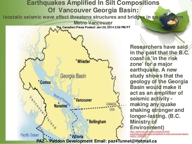
Looking northward, a bit of information about the seimic situation in the Vancouver, British Columbia, region is linked here. The page it titled 'Georgia Basin Could Amplify Ground Shaking In Next Vancouver Earthquake.' The Vancouver region in Canada does also warrant further investigation.
For further reading:
Current Expectations for a Cascadia Mega-Quake
https://cascadian.neocities.org/cascadiaquake.htm
Friday, September 22, 2017
Built on Very Shaky, rather Dangerous Ground
There are things that the residents of the Cascadia region of North America, plus those especially in southeast California (around the Salton Sea and Salton Trough region, and even northward from there), can learn from the earthquakes which have occurred recently in Mexico. Some of the lessons relate to buildings and structures located on sedimentary materials --- especially if this sedimentary material resides within a bowl-shaped pocket of harder rock.
A New York Times page, linked here, is titled 'Mexico City Was Built on an Ancient Lake Bed. That Makes Earthquakes Much Worse.' The page notes that much of Mexico City resides "on layers of sand and clay --- up to 100 yards deep --- that used to be under the lake." Yes, much of Mexico City is built, as the page states, on "soft, water-laden sediments [which] make the city uniquely vulnerable to earthquakes and other problems."
The page linked above does a reasonable job of explaining why earthquake waves are amplified in this sedimentary material upon which Mexico City is built --- yes, waves which can be amplified to "a hundred times stronger than they would be otherwise." It also notes that the way things are geologically configured beneath the city causes "the amplified shaking [to] last longer." Furthermore, this sedimentary material in a bowl of harder rock can amplify and be seriously affected by earthquakes which are centered a great distance away, while surrounding areas on firmer ground are hardly affected.
The following linked pages contain information about the dangers of building on soft, sedimentary materials --- especially when it comes to massive earthquakes.
A page, linked here, notes that Mexico City "is built on a dried-up ancient lake bed." The page states further that "these soft sedimentary clay deposits amplified the seismic waves, or they liquefied, destroying the foundations of some buildings."
A Los Angeles Times page, linked here, has a video which shows what can happen to even a concrete building in these sedimentary-type conditions just mentioned. The building in the video starts wobbling and concrete starts falling. Then, suddenly, things just crash to the ground. The linked page speaks about the dangers of these concrete buildings --- buildings of a type which, many like them are found in the Cascadia and southern California regions, plus elsewhere in "earthquake country."
A Smithsonian page, linked here, is titled 'How Mexico City's Unique Geology Makes Deadly Earthquakes Even Worse.' The page states: "The geology of Mexico --- and particularly that of Mexico City --- makes it a perfect storm for seismic catastrophe." And, why is this? It is because "Ancient sediments that underlie the city trap and magnify the vibrations that ripple through the region." A good explanation is given in the linked page for why this happens.
A page from Phys.org, linked here, is titled 'Soft soil makes Mexico City shake like it was built on jelly.' The page states this soft soil "amplified the shaking from Tuesday's earthquake and increased its destructive force." The page indicates that seismic waves which enter the softer soil area via the hard rocks below are then "amplified by the soil and sediments above," which makes things on the surface "shake longer and more intensely." The page states further: "The same deep soft soil effect worsened the deadly 2015 Nepal earthquake because Katmandu is also built on a dry lake bed."
The Phys.org page linked above states that "Los Angeles, Seattle and the San Francisco Bay area have soft soil that can amplify seismic waves," plus "New Zealand has been affected by similar issues in past quakes." Regarding Seattle, Washington, a King5.com page, linked here, is titled 'Why Seattle geology makes earthquakes worse.' A caption states: "Mexico City and Seattle have a lot in common when it comes to earthquakes. One example, the soil the cities sit on can actually amplify the effects and length of the shaking." The page also states: "Both Seattle and Mexico City are built on top of soil that's surrounded by rocks." That means that Seattle can take a real beating in a massive quake. Definitely not something to look forward to.
So, let us take a closer look at those earthquake-amplifying, sedimentary filled, "bowls-of-rock" which are beneath Seattle and other cities in the region. For those who have a relatively good grasp on maps, an image, linked here, shows the general contour of the rock-bowls which reside beneath the Seattle and Everett areas. Then, looking at the "much bigger picture" in the Cascadia region, a page linked here, shows the 40 to 60 kilometer deep Georgia Basin of northwest Washington and southwest British Columbia. This is a huge earthquake-amplifying basin which is filled with "soft glacial sediments and sedimentary rocks." An image and text, which are linked here, agree with this conclusion.
In all of this, there is something to consider. In the Cascadia region, there are many areas where buildings and other structures are built on sedimentary-type fill materials, which reside above harder bedrock. California also has many places where sedimentary-type materials are all that is supporting buildings and other structures. These materials can lose their strength and even experience serious liquefaction in a massive earthquake. This type of situation can allow even strongly built buildings and structures --- including bridges --- to tip sideways, fall over or simply collapse.
Looking into the Portland, Oregon area, regarding another matter, a KGW.com page, linked here, speaks of damage which likely could happen to the Interstate Bridge over the Columbia River, between Portland and Vancouver. It declares: "In a major quake, the drawbridge towers holding the counterweights would buckle, sending giant blocks of concrete into a free fall. That counterweight would come down just like a hammer, smashing through the bridge deck." But, there is more to this story.
Those falling counterweights would thoroughly smash any vehicles and people which happen to be on the roadway beneath them. Other vehicles may also slam into the concrete weights at freeway speed, as the large weights hit the roadway. The carnage in just this one area could be stunning, especially if it happened during a time of heavy traffic. Similar things could also happen in other cities in the Cascadia region, because of falling structures, etc. Seattle and other cities up and down the Pacific Coast and the inland Interstate-5 Freeway corridor all have their problems which make them rather vulnerable to great earthquakes.
Now, back to building on sedimentary materials and the Portland, Oregon area. Along the Willamette River, on a thick layer of sedimentary fill, is the six mile long, Critical Energy Infrastructure Hub (CEI). This is a six-mile stretch of fuel storage tanks and refineries, located right next to the Willamette River. What is worse, all this infrastructure is built on top of soft, sedimentary materials (link). The CEI holds a 3 to 5 day supply of petroleum products for the state of Oregon. In a massive earthquake, storage tanks may rupture and a large share of this stored fuel may be spread downstream in the Willamette and Columbia river systems. Furthermore, this fuel could be on fire. Up in the Puget Sound region of Washington state exists similar vulnerabilities, in the event of a massive quake.
Along the rivers and waters in many areas of the Pacific Northwest, and even in British Columbia, Canada, are many residential, commercial and industrial structures built on soft, earthquake-vulnerable, sedimentary materials. Research indicates that possibly the region around Seattle, Washington and Vancouver, British Columbia is no better off than Mexico City, in this regards (1)(2). The same holds true for may other cities of the Pacific Northwest region, and even in California, which are built near and along waters, or even on filled, swampy areas.
Let us now begin comparing who may actually have things worse. The recent Mexico earthquake was only an M7.1. A Cascadia earthquake, on the other hand, if it unleashes its full potential, could possibly be greater than an M9.2. That means a Cascadia quake at its full potential could be about 1000 times stronger than the recent quake in Mexico, and that quake in Mexico did a lot of damage. Therefore, in Cascadia, it may be wise to prepare for unimaginable damage and destruction --- along with numerous injuries and deaths, more than you would ever like to think about.
Looking further, after a massive West Coast seismic event, it may be wise to plan on surviving basically on your own for an extended period of time --- possibly even much longer than just two weeks. Those who have not properly prepared may be of little or virtually no use to anyone, especially to themselves, in this type of situation.
Let us now look at one particular location in southeastern California, to see their predicament. Let us consider the vulnerability of people and structures around the Salton Sea and surrounding region. Let us begin, by once again stating that much of Mexico City is built on layers of sand and clay which are up to 100 yards (or, up to 300 feet) deep. Remember this depth of sedimentary material, as we continue with this discussion. That depth of sedimentary material beneath Mexico City is very minor compared to the depth of sedimentary materials which exists in the Salton Trough --- in that area from the tip of the Gulf of California, northward, through the Colorado River Delta and Mexicali Valley in Mexico, plus the Imperial and Coachella valleys in California.
Almost one-third of the way down a page, linked here, is information on the Salton Trough. It states: "This formation, sediment nearly 9 miles deep, can trap earthquake energy and amplify seismic waves, resulting in longer, more intense shaking." Furthermore, in this area, people "live a couple of hundred feet below sea level with a 30 foot high pile of sand between you and the ocean." And yes, there is something else to think about.
If there is truly anywhere remotely near 9 miles deep of silt and sand beneath this area in which people live, it could potentially become rather unstable and possibly even somewhat movable, during a massive earthquake in the trough. In a state of severe and extended shaking, could this rather weak, sandy and sedimentary material still hold back the waters of the Gulf of California, which are a couple of hundred feet above the surface of the Imperial and Coachella valleys?
It is good to have at least a second or third opinion when looking at things like what is being dealt with, geologically, in a particular region and the depth of sedimentary materials which are presently all that is holding up your house or other structures --- especially when it is seismically-vulnerable sedimentary materials. A page on the San Diego State University (SDSU) website, linked here, states the following:
"The Gulf of California and the Salton Trough are components of a single geologic structure that averages less than 100 miles in width yet is more than 1,000 miles long. In this context, the Salton Trough is considered the landward extension of the Gulf. This point becomes clear when one considers that the Salton Valley exists only because the Colorado River delta is a natural earthen dam that completely excludes the waters of the Gulf. If it was not for that dam, the Valley would be submerged as far north as Indio."
The SDSU page also states: "The basement rocks under the north end of the Gulf are covered by as much as 25,000 to 30,000 feet of these deltaic sediments [from the Colorado River]." Well, 25,000 to 30,000 feet of sediments is only about 5 to 5-1/2 miles of seismically-shaky sedimentary materials --- which is far less that the 9 mile thickness of sediments noted in the page linked further above. But, even 5 to 5-1/2 miles of seismically-shaky sedimentary materials in much more than the mere "up to 300 feet" of sedimentary materials beneath Mexico City. So, it appears that people in the southeastern region of California could potentially be in a worse predicament.
A page associated with the University of California, Santa Barbara, linked here, states that "at the head of the Gulf of California, including the Salton Trough," there is "a vertical thickness of about 6,000 m (20,000 ft) of young sediments, mainly derived from ancestral Colorado rivers, has accumulated on spreading quasi-oceanic floor as the gulf has opened." Okay, so 20,000 feet of sediments in the Salton Trough is still about 66 times deeper in those seismically-shaky materials than that mere 300 feet of unstable sedimentary materials beneath Mexico City. And, just look at what has happened to Mexico city during serious earthquakes, over the years. Yes, there has been a lot of destruction and many people have died. So, what could it by like in southeastern California, if a massive earthquake were to hit in that region?
A Southern California Earthquake Center page, linked here, presents information relating to "the sedimentary basin in the Salton Trough, southern California." An earthquake simulation was done on a structural model of the Salton Trough. What did it show? The page states: "These simulations indicate that great amplification will occur during large earthquakes in the region due to the low seismic velocity of the sediments and the basin shape and depth." Further information relating to the seismic hazard in the Salton Trough region is found in a page linked here.
The writer wishes you all the best in the days ahead. Do yourself a favor and get properly prepared as quickly as you can. Nature waits for no one!
For further reading:
Current Expectations for a Cascadia Mega-Quake
https://cascadian.neocities.org/cascadiaquake.htm

Saturday, September 2, 2017
Yellowstone and the Cross Country Rift
The Yellowstone Supervolcano has been in the news lately (link). It is noted that the earthquake swarm now happening at Yellowstone is one of the largest ever recorded. But, there is one thing that this sporadic blogger has noted about the Yellowstone hotspot.
An article from the December 17, 1981 edition of the Spokane Daily Chronicle, which is linked here, includes a map which indicates the general location of a large (or rather, very large), ancient rift. This ancient rift cuts diagonally across the United States --- from the state of Georgia to the state of Washington. Now, there is something worth noting on this map.
Look at the state of Wyoming (WYO.) on this map. Observe how the diagonal line (the general location of the great rift) passes through the northwest corner of the state of Wyoming. So, what is important about this northwest corner of Wyoming. Yes, that is the location of Yellowstone National Park --- or more clearly, the Yellowstone Supervolcano.
To this sporadic blogger, it does appear that the Yellowstone Supervolcano may, in some way, be associated with the giant cross country rift. It appears that the Yellowstone Supervolcano is associated with this zone of weakness which extends deep into the continental crust. But, there is more to this story. From Yellowstone, this cross country rift (or zone of weakness) heads generally northwest, into the state of Washington.
Now, the blogger's research has led him to believe that the giant rift in Washington state continues in its westerly course, beneath the thick basalt flows of the Columbia River Lava Plateau. The blogger believes that the giant rift then exits the continental landmass on the west side of the Cascade Mountains in the form of that deep submarine canyon called the Strait of Juan de Fuca.
Once again, let us note that, from the blogger's research, it appears that the zone of weakness (the giant rift) extends from the Yellowstone Supervolcano to the Strait of Juan de Fuca. Now for some questions.
Should the Yellowstone Supervolcano experience a massive earthquake or a huge eruption, could it trigger a Cascadia Megaquake as a result of energy transferred via the giant rift? On the other hand, could a massive Cascadia Megaquake, as a result of energy transferred via the giant rift, trigger a devastating Yellowstone Supervolcano eruption?
For further reading:
Current Expectations for a Cascadia Mega-Quake
https://cascadian.neocities.org/cascadiaquake.htm
Thursday, May 11, 2017
Puget Sound Region and Earthquake Swarms
In recent times, there has been an ongoing swarm of small earthquakes in the Puget Sound region. This swarm of quakes is mainly concentrated in the area between Bremerton, Washington and Bainbridge Island.
A news article about this quake swarm, from early Thursday (5-11-2017), linked here, notes that "There have been 18 temblors in the last 24 hours, and the Pacific Northwest Seismic Network has recorded 42 tiny quakes since May 3." The article notes that this quake swarm is occurring on "the western edge of the Seattle fault." The article states further that "Seismologists believe the quakes are being caused by fluid moving underneath the earth’s crust."
The concentration of ongoing earthquakes in this swarm, being in one area of the Puget Sound region, does get the writer's attention. His research over the years has located information about a number of unique geologic occurrences in the waters of northwest Washington and southwest British Columbia. These rather strange occurrences are things of which the public should possibly be aware.
Now, once again looking at first paragraph, the seismologists "believe the quakes are being caused by fluid moving underneath the earth’s crust." Moving fluid means something beneath the fractured and faulted area surrounding the Kitsap Peninsula is not truly solid. This fluid which is moving is most likely extremely hot, molten magma --- yes, the stuff that comes out of volcanoes. At this point, there is something to consider.
Fluid, or molten magma, which is moving below the surface of the earth can potentially increase or decrease in pressure. Depending on the geologic structure surrounding or above a fluid of changing pressure, things potentially can move. Landmasses, islands or seabed can potentially sink or rise. It is a matter of simple hydraulics.
With the above information in mind, it is now time to consider just a couple of the rather strange geologic events which have occurred in these waters of northwest Washington and southwest British Columbia.
A web page, linked here, contains the following information. "During a magnitude 7.3 earthquake in the Strait of Georgia off British Columbia in June 1946, the seabed sunk nearly 85 feet in some places." This quake was also called the 1946 Vancouver Island earthquake. A Wikipedia entry linked on the page states that "The tectonics that caused the 1946 Vancouver Island earthquake are poorly known." But, there is more to this story.
The linked Wikipedia entry also states: "Land subsidence resulted from the earthquake, most commonly around shorelines on the Strait of Georgia. This included the bottom of Deep Bay which sank between 2.7 m (9 ft) and 25.6 m (84 ft)."
Deep Bay is shaped somewhat like an open-ended, irregular oval, as the following links illustrate: (1) (2) (3) (4). This radical sinking is something to take seriously, especially when considering the possibility of major earthquakes in the Puget Sound region.
There is even a more strange geologic occurrence which happened in the San Juan Islands at the same time as the 1906 San Francisco earthquake. At the time of the California quake, an island in the San Juans sank, and very strangely, later rose again. This particular island was called Denver Island.
A web page, linked here, contains links to articles from 1907 and 1908 which present some very interesting information about this very unusual geologic event at Denver Island. This event was likely caused by moving fluids, or molten magmas, below the earth's crust.
It appears that Denver Island may have been supported by pressurized magma. It appears that during the 1906 San Francisco earthquake, this supporting magma lost some of its pressure. This loss of pressure allowed the island to sink beneath its surrounding waters. Later, the pressure appears to have increased in the molten magma beneath the island and it was then, once again, raised above the waters of the region. This is just simple hydraulics in action.
So, what unusual or potentially catastrophic geologic events lie ahead for the Puget Sound region? Well, only time will tell. But, I can say one thing for sure. I am not in any hurry to move to the Puget Sound region.
For further reading:
Current Expectations for a Cascadia Mega-Quake
https://cascadian.neocities.org/cascadiaquake.htm


Saturday, March 25, 2017
Cascadia and Lessons in Realistic Earth Movement
As more information is steadily coming in about the November 2016 New Zealand earthquake, there may be more things which need to be considered about large seismic events. Possibly, there are some very important lessons to be recognized in this event, especially by people living in the Cascadia region of North America. For starters, let us examine an article, linked here, which is titled 'Kaikoura earthquake moved the South Island, new research shows.' So, exactly how much did the South Island move in this quake? According to the article, parts of the island moved "more than 5 metres [more than 16 feet] closer to the North Island."
There is something found in the article linked above which is a bit disturbing. The scientific community has put a lot of time and taxpayers' money into investigating earthquakes, but the characteristics of the New Zealand earthquake "could not have been predicted by existing models." So, it appears that these models and methods which the scientists have been using are seriously flawed. Obvious problems of this nature do not sound good, especially for people who live in the Cascadia region of western North America and who are putting their "blind" faith in the scientists of that region and their flawed models.
A BBC article, linked here, is titled 'Kaikoura: Most complex quake ever studied.' Regarding the models of the scientists, when considering what happened in the New Zealand quake, one geophysicist declared: "What we saw was a scenario that would never have been included in our seismic hazard models." Once again, there is a question which we should be asking ourselves. Is the same thing happening with the scientists and their models in the Cascadia region of North America? When Cascadia breaks loose, will everyone once again be totally surprised? Will the scientists once again be utterly blindsided, because the actual event does not match their models and what they think Nature should do?
A page, linked here, notes Dr Ian Hamling, of GNS Science, as stating: "Some of the apparent jumps between faults I don't think any seismic hazards model in the world would have considered a possible scenario." Okay, so the words "any seismic hazards model in the world" should also include those seismic hazard models which are being used by the scientists in the Cascadia region of North America --- as they work to predict the characteristics of the coming, massive Cascadia seismic event. But there is something even more important to noted in the page. These flawed seismic models of the scientists "are used by authorities for building codes." Do you see where all this is leading?
The authorities are setting the standard for seismic building codes based on the flawed and underestimated models of the scientists. So, the outcome of all this should be rather obvious to any thinking individual. It appears that in Cascadia and around the world, things are being set up for an incredible amount of devastation and loss of human life, because the seismic building codes are being set much too low. Buildings and other structures built to these flawed codes in the Cascadia region can potentially fail, possibly even catastrophically, when Cascadia finally breaks loose with its full potential. Bottom line is, the damage has already been done. Many buildings and other structures, including bridges, have been built in accordance with these flawed codes.
Near the end of the page, linked here, something else is brought out which is somewhat unsettling. It states: "If [the Kaikoura earthquake (in New Zealand)] had happened 1000 years ago ... if you were to look at it with current paleoseismic methods that are available you would see it as separate individual events. You would never consider it as a single rupture." Let it now be noted that these same "scientific" methods are generally used to "interpret" what has happened in the geologic past in the Cascadia region of North America. It is therefore very possible that a certain percentage of what the scientists are declaring as being the results of separate seismic events may, in fact, actually have happened in a single, extremely powerful event in the past.
The latter part of the page linked above reinforces the above possibility. The page states: "It may be in fact that past earthquakes which were considered as smaller, individual ruptures, potentially could have been one big rupture. That feeds into long term hazards, in which you can end up with larger events than you might expect." So, in Cascadia, the scientists with their expensive, potentially flawed models and toys have been predicting possibly an M9.0 or an M9.2 seismic event. So, it is time for all thinking individuals to begin questioning what we shall really experience, once Cascadia breaks loose with its full potential.
Moving onward, an article at phys.org, which is linked here, is titled 'Kaikoura quake may prompt rethink of earthquake hazard models internationally.' The article states that this 2016 New Zealand earthquake "was so complex and unusual that it is likely to lead to changes in the way scientists think about earthquake hazards in plate boundary zones worldwide." At this point, let it be noted that the Cascadia region of North America is also located over a plate boundary zone. It is located over the boundary between the Pacific Plate and the North American plate.
Looking again at New Zealand, the article linked above declares: "The earthquake ruptured at least 12 major crustal faults plus another nine lesser faults and there was also evidence of slip along southern end of the Hikurangi subduction zone plate boundary..." So, a lot of unusual things were happening during this New Zealand earthquake event. The page also states: "The largest movement during the earthquake occurred on the Kekerengu Fault, where pieces of the Earth's crust were displaced relative to each other by up to 25m [up to 82 feet] at a depth of about 15km." That is a lot of movement in one event. So, considering these things, what potentially can be expected in the Cascadia region in the days ahead?
An article, linked here, is titled 'New Zealand's 2016 Kaikoura earthquake was one of the most complex ever recorded.' Why is this quake now being considered as "one of the most complex ever recorded?" In this earthquake event, scientists have "discovered up to 12 faults ruptured at great distances apart -- a finding that may mean current hazard models need to be completely rethought. It could also mean the risk of large earthquakes elsewhere are more likely." This information leads to a question. Are there lessons from the New Zealand earthquake which better be rapidly applied to the extremely complex Cascadia region, so that we can realistically consider and better prepare for what is coming?
The article linked above notes that "there were surface ruptures on at least 12 major faults up to 15km [up to 9 miles] apart, with extensive uplift along much of the coastline." The article states that "these results were of huge surprise." Yes, the scientists were totally surprised and blindsided, just as they were in the Sumatra quake of 2004 and the Japan quake of 2011, plus in quakes elsewhere (1)(2)(3).
In New Zealand, the general scientific community had absolutely no clue that something like this November 2016 seismic event could ever happen. Again, is there a major lesson in all of this for those who reside in the Cascadia region of North America? Is there a major lesson in this for those who reside in the states of Washington, Oregon and California, plus those in British Columbia, Canada? Is there a major lesson for those who may be rather "blindly" putting their faith in what the scientists and mainstream news media are telling them about the potential characteristics and danger of the next Cascadia megaquake event --- which they are basing on flawed models?
Yes, the New Zealand quake event is totally "challenging current assumptions [in the scientific community] about earthquakes." The New Zealand quake propagated along both "mapped and unmapped faults." These unmapped or undiscovered faults --- these faults which are completely unknown to most of the scientists prior to the actual earthquake event --- are the "wild card" in any earthquake event. These unknown and unmapped faults --- of which there are many in the Cascadia region --- can have a great effect on the characteristics and outcome of a major earthquake event. These unknown and unmapped faults will definitely have a great effect on what will be happening in the next, massive Cascadia earthquake event and what will be happening to residents of this region. But there is more to this story.
The article about the New Zealand quake --- which we have now been drawing information from --- indicates that the final rupture length experienced during this event "was largely due to stress levels and geometric complexities." So, what is happening in the Cascadia region of North America? What kind of stress levels and geometric complexities exist in this region? A section in a page titled 'Current Expectations for a Cascadia Mega-Quake,' which is linked here, speaks of "dextral torsion between the North American and Pacific plates." A section of that page, linked here, has links to diagrams which "show the clockwise rotation of the western parts of California, Oregon and Washington around the elliptical basin, based on GPS data."
A section in a webpage, linked here, is titled "Wound Up to Breaking Point." It notes that this geologic stress being steadily built up in the Cascadia region "amounts to a large spring being wound. More and more tension is steadily added. At some point, the stress in the landmass will cause it to reach its breaking point." The page states further: "When all of the pent up stress finally breaks things loose, it appears that part of the initial line of rupture occurs relatively close to the Interstate-5 freeway corridor, rather than far offshore at what is called the Cascadia Subduction Zone." It appears that the Cascadia region of western North America could then experience a new, world record in a single earthquake event.
A page linked here is titled 'Researchers have dramatically underestimated the risk of earthquakes...' Why is this? The page states: "Maps showing the estimated hazard posed by quakes in different regions are generally based on the assumption of single segment ruptures." The page continues: "In earthquake scenarios where fault segments link up, there is a bigger area available to rupture, ramping up the quake's energy." And so, in the next Cascadia event, there may realistically be a number of faults which link up --- some of them being rather large and complex faults and even giant rifts. This should make for one incredible seismic event.
The page linked above contains the following statement: "The Kaikoura quake will likely remain unparalleled for some time." Yes, this New Zealand event may remain unparalleled --- unparalleled until Cascadia cuts loose in all its glory. Possibly that is why the page also states that "we may find that the 2016 events and the wisdom gained could be overshadowed in the not so distant future." Yes, Cascadia, in all its glory, may soon bring things to a whole new level of seismic and geologic understanding.
For further reading:
Current Expectations for a Cascadia Mega-Quake
https://cascadian.neocities.org/cascadiaquake.htm