The blog post from Saturday, September 24, 2016, speaks about the Seattle Fault Zone. One very important point was mentioned about this zone, that being that most of the faults in this zone are classed as being "blind" or concealed faults. This means that these are faults which do not reach to the surface of the ground. They are actually hidden from view.
Sometimes, concealed faults are not discovered until a devastating earthquake is associated with them (example). Concealed faults make things rather difficult for scientists, especially when it comes to knowing where a quake may strike, plus how large these quakes could potentially be. But, there is more to the story about concealed faults in the Pacific Northwest.
A news article from 1981, linked here, speaks about a giant rift which spans diagonally across the United States -- from Georgia to eastern Washington. But it appears that scientists do not know what happens to this giant rift inside of the state of Washington. Why is this?
The article linked above states: "Geologists haven't been able to trace fault systems from north Idaho into Washington, in part because of alluvial deposits and the basalt covering over older rocks west of Spokane." So, at this point there is an important question to ask. Just how big of an area is covered by this basalt which makes it hard to detect the buried faults and rifts in the older continental crust? Furthermore, how thick are these basalt flows which may prevent scientists from discovering faults and rifts?
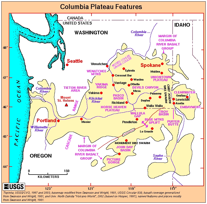
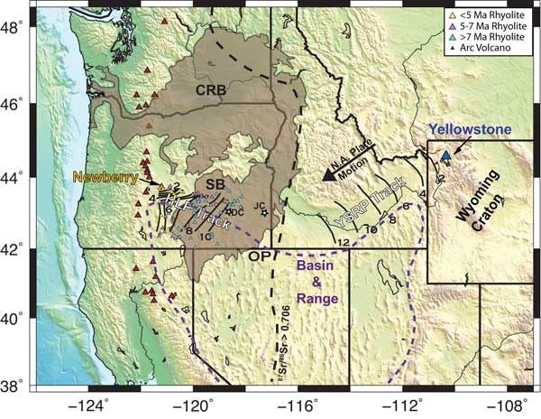
Let us consider the general area of the basalt flows first. Maps of the general extents of the Columbia River Flood Basalts are found at the following links: (1) (2) (3) (4) (5) (6) (7) (8). Yes, there is quite a large area in Washington and northern Oregon, plus some in Idaho, which has been buried under these basalt flows.
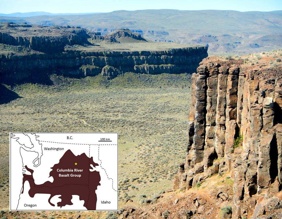
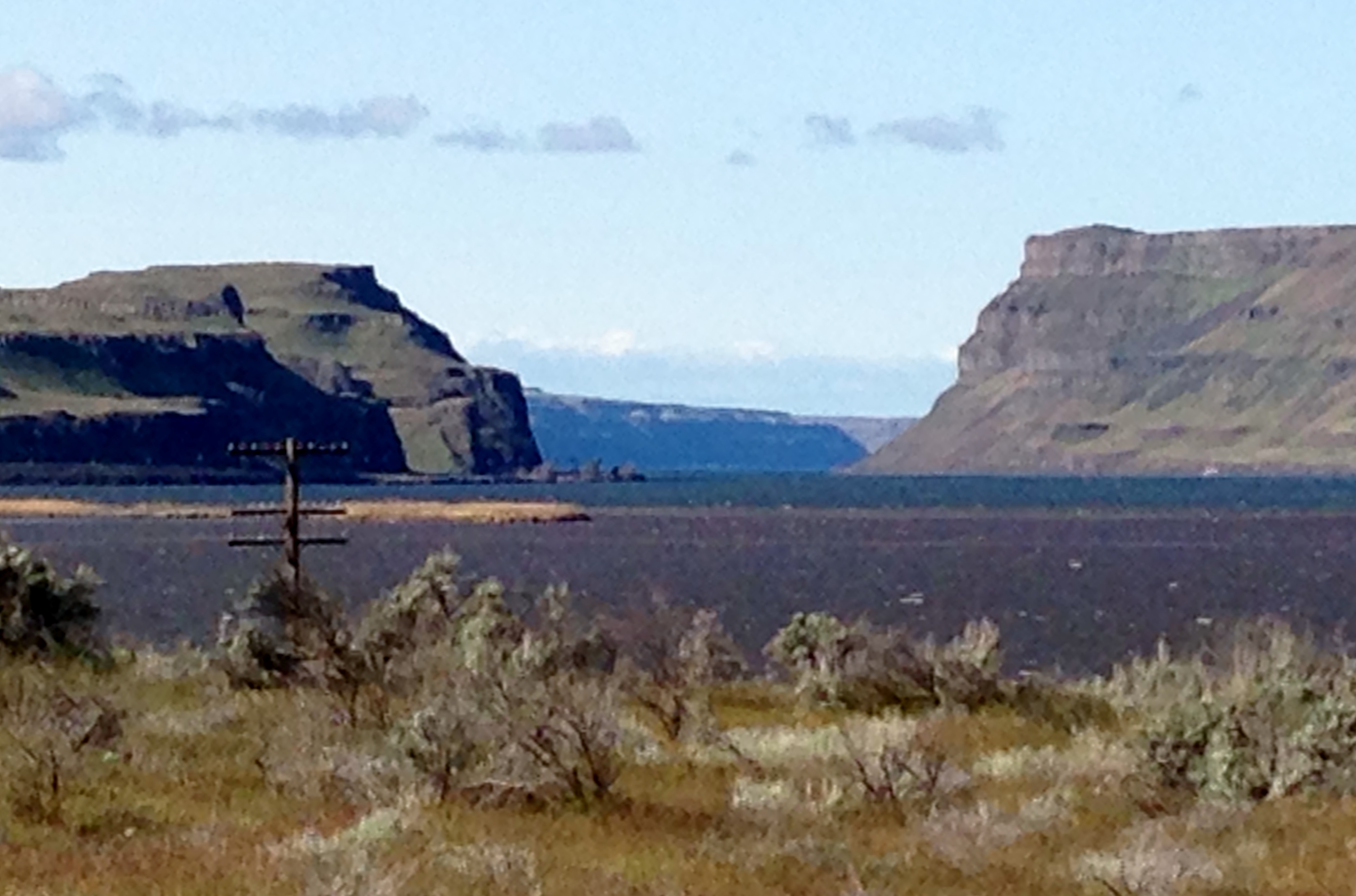
Let us now consider the thickness of basalt flows in the Pacific Northwest. The following linked pictures give just some idea of the thicknesses of individual basalt flows, which worked together to virtually cover the land and bury older rock formations, plus their included faults and rifts: (1) (2) (3) (4) (5) (6) (7) (8) (9) (10).
Now, for another important question. Just how thick are the multiple flows of basalt which cover the land? Of the basalt flows, a page, linked here, states: "By the time these eruptions ceased, most of the Columbia Basin was coated with basalt rock at least one mile thick. In the central and southern Yakima Valley the accumulated basalt measures three miles in depth."
Let us now consider the thickness of individual flows, as they moved across the countryside, virtually burying everything in their path. A page, linked here, declares: "It is believed that the fronts of the lava flows were several stories (approximately 30 meters) high as they flowed from the eruption center at speeds up to three miles per hour. These basalts erupted from long fissures in the ground, not from volcanic cones."
A page on the Western Oregon University site, linked here, gives a slightly different story. On PDF page 3 of 19, is found the following: "Thick, successive outpourings of lava spread over the landscape often moving at a speed of up to 30 miles an hour to form the Columbia River basalts, the primary group in the plateau today." Regarding the maximum thickness of these basalt flows, the following is found on PDF page 4 of 19: "The Columbia River Basalt Group develops its maximum thickness of nearly 15,000 feet under the Columbia Plateau near Yakima, Washington."
On the Western Oregon University page, linked above, take a look at the 3-D wireframe surface chart at the top of PDF page 4 of 19. This wireframe illustrates the general shape of the contact between the bottom of the Columbia River Basalt Group and the continental crust beneath it. This brings up a question. Was it the weight of the basalt flows which caused things to sink down in the center of this large area, or was there already a depression in the continent in this region, before the basalt began to flow?
While the question above is considered, let us look at a different point of view about these basalt flows. Let us consider one statement from a source, which is linked here. According to the source, evidence "indicates that the lava flows responsible for the Columbia River basalts have traveled some 750 km without significant changes in temperature, and this implies 'extraordinarily rapid emplacement.'" This bit of information may be something for us to seriously consider.
The maps linked above show the general area of the large, Columbia River Basalt flows. But, how large was the actual area covered by these flows? According to a webpage on the Oregon State University website, linked here, "The Columbia River Flood Basalt Province forms a plateau of 164,000 square kilometers between the Cascade Range and the Rocky Mountains."
At this point, there is something to consider. After looking at the 3-D wireframe surface chart, linked above, and considering the area which was covered by these basalt flows, it is more easily understood why scientists are having a hard time tracing faults or rifts from Idaho into Washington and northern Oregon. Yes, they are buried deep down and clues which reveal their presence may not always show on the surface. Furthermore, there are alluvial deposits to contend with, which may also conceal faults in near-surface bedrock.
A Wikipedia entry on alluvium, linked here, states that it is "loose, unconsolidated...soil or sediments, which has been eroded, reshaped by water in some form, and redeposited in a non-marine setting." Some of the material which make up alluvium are "fine particles of silt and clay and larger particles of sand and gravel." This material can then form deposits which hide the characteristics of the rock surface beneath them. These deposits can be anywhere in a range from relatively thin to relatively thick -- up to a hundred or more feet thick. So yes, scientists do have their challenges when it comes to finding hidden faults.
There is one more thing to consider, when it comes to major earthquakes in the Cascadia region in the times ahead. It appears that it could be movement on the faults and rifts in the deeply-buried older rocks which can take us utterly by surprise. It could also be movement on these deeply-buried faults and rifts which could initiate earthquakes on faults closer to the surface. Movement from beneath could also link up with a number of faults closer to the surface, producing simultaneous earthquakes of a large magnitude. These are things worth considering in the Cascadia region of North America.
For further reading:
Columbia River Basalt Group Stretches from Oregon to Idaho
https://volcanoes.usgs.gov/observatories/cvo/cvo_columbia_river_basalt.html
Geology, Age and Extent of the Columbia River Basalts
http://geology.isu.edu/Digital_Geology_Idaho/Module10/mod10.htm
The Columbia River Basalts in the Northwest States
http://michael.oards.net/pdf/PostFloodBoundary/Chp37Version3.pdf
Field studies in the Columbia River basalt, Northwest USA
http://creation.com/field-studies-in-the-columbia-river-basalt-northwest-usa
Current Expectations for a Cascadia Mega-Quake
https://cascadian.neocities.org/cascadiaquake.htm
No comments:
Post a Comment