Tuesday, September 27, 2016

Concealed Faults and Rifts in the Pacific Northwest

The blog post from Saturday, September 24, 2016, speaks about the Seattle Fault Zone. One very important point was mentioned about this zone, that being that most of the faults in this zone are classed as being "blind" or concealed faults. This means that these are faults which do not reach to the surface of the ground. They are actually hidden from view.

Sometimes, concealed faults are not discovered until a devastating earthquake is associated with them (example). Concealed faults make things rather difficult for scientists, especially when it comes to knowing where a quake may strike, plus how large these quakes could potentially be. But, there is more to the story about concealed faults in the Pacific Northwest.

A news article from 1981, linked here, speaks about a giant rift which spans diagonally across the United States -- from Georgia to eastern Washington. But it appears that scientists do not know what happens to this giant rift inside of the state of Washington. Why is this?

The article linked above states: "Geologists haven't been able to trace fault systems from north Idaho into Washington, in part because of alluvial deposits and the basalt covering over older rocks west of Spokane." So, at this point there is an important question to ask. Just how big of an area is covered by this basalt which makes it hard to detect the buried faults and rifts in the older continental crust? Furthermore, how thick are these basalt flows which may prevent scientists from discovering faults and rifts?

Let us consider the general area of the basalt flows first. Maps of the general extents of the Columbia River Flood Basalts are found at the following links: (1) (2) (3) (4) (5) (6) (7) (8). Yes, there is quite a large area in Washington and northern Oregon, plus some in Idaho, which has been buried under these basalt flows.

Let us now consider the thickness of basalt flows in the Pacific Northwest. The following linked pictures give just some idea of the thicknesses of individual basalt flows, which worked together to virtually cover the land and bury older rock formations, plus their included faults and rifts: (1) (2) (3) (4) (5) (6) (7) (8) (9) (10).

Now, for another important question. Just how thick are the multiple flows of basalt which cover the land? Of the basalt flows, a page, linked here, states: "By the time these eruptions ceased, most of the Columbia Basin was coated with basalt rock at least one mile thick. In the central and southern Yakima Valley the accumulated basalt measures three miles in depth."

Let us now consider the thickness of individual flows, as they moved across the countryside, virtually burying everything in their path. A page, linked here, declares: "It is believed that the fronts of the lava flows were several stories (approximately 30 meters) high as they flowed from the eruption center at speeds up to three miles per hour. These basalts erupted from long fissures in the ground, not from volcanic cones."

A page on the Western Oregon University site, linked here, gives a slightly different story. On PDF page 3 of 19, is found the following: "Thick, successive outpourings of lava spread over the landscape often moving at a speed of up to 30 miles an hour to form the Columbia River basalts, the primary group in the plateau today." Regarding the maximum thickness of these basalt flows, the following is found on PDF page 4 of 19: "The Columbia River Basalt Group develops its maximum thickness of nearly 15,000 feet under the Columbia Plateau near Yakima, Washington."

On the Western Oregon University page, linked above, take a look at the 3-D wireframe surface chart at the top of PDF page 4 of 19. This wireframe illustrates the general shape of the contact between the bottom of the Columbia River Basalt Group and the continental crust beneath it. This brings up a question. Was it the weight of the basalt flows which caused things to sink down in the center of this large area, or was there already a depression in the continent in this region, before the basalt began to flow?

While the question above is considered, let us look at a different point of view about these basalt flows. Let us consider one statement from a source, which is linked here. According to the source, evidence "indicates that the lava flows responsible for the Columbia River basalts have traveled some 750 km without significant changes in temperature, and this implies 'extraordinarily rapid emplacement.'" This bit of information may be something for us to seriously consider.

The maps linked above show the general area of the large, Columbia River Basalt flows. But, how large was the actual area covered by these flows? According to a webpage on the Oregon State University website, linked here, "The Columbia River Flood Basalt Province forms a plateau of 164,000 square kilometers between the Cascade Range and the Rocky Mountains."

At this point, there is something to consider. After looking at the 3-D wireframe surface chart, linked above, and considering the area which was covered by these basalt flows, it is more easily understood why scientists are having a hard time tracing faults or rifts from Idaho into Washington and northern Oregon. Yes, they are buried deep down and clues which reveal their presence may not always show on the surface. Furthermore, there are alluvial deposits to contend with, which may also conceal faults in near-surface bedrock.

A Wikipedia entry on alluvium, linked here, states that it is "loose, unconsolidated...soil or sediments, which has been eroded, reshaped by water in some form, and redeposited in a non-marine setting." Some of the material which make up alluvium are "fine particles of silt and clay and larger particles of sand and gravel." This material can then form deposits which hide the characteristics of the rock surface beneath them. These deposits can be anywhere in a range from relatively thin to relatively thick -- up to a hundred or more feet thick. So yes, scientists do have their challenges when it comes to finding hidden faults.

There is one more thing to consider, when it comes to major earthquakes in the Cascadia region in the times ahead. It appears that it could be movement on the faults and rifts in the deeply-buried older rocks which can take us utterly by surprise. It could also be movement on these deeply-buried faults and rifts which could initiate earthquakes on faults closer to the surface. Movement from beneath could also link up with a number of faults closer to the surface, producing simultaneous earthquakes of a large magnitude. These are things worth considering in the Cascadia region of North America.


For further reading:

Columbia River Basalt Group Stretches from Oregon to Idaho
https://volcanoes.usgs.gov/observatories/cvo/cvo_columbia_river_basalt.html

Geology, Age and Extent of the Columbia River Basalts
http://geology.isu.edu/Digital_Geology_Idaho/Module10/mod10.htm

The Columbia River Basalts in the Northwest States
http://michael.oards.net/pdf/PostFloodBoundary/Chp37Version3.pdf

Field studies in the Columbia River basalt, Northwest USA
http://creation.com/field-studies-in-the-columbia-river-basalt-northwest-usa

Current Expectations for a Cascadia Mega-Quake
https://cascadian.neocities.org/cascadiaquake.htm


Saturday, September 24, 2016

The Seattle Fault Zone and Beyond...Considerations

What is the Seattle Fault about? What kind of seismic hazard does it really present to Seattle and the surrounding area? A Wikipedia entry on the Seattle Fault, linked here, declares: "The Seattle Fault is a zone of multiple shallow east-west thrust faults that cross the Puget Sound Lowland and through Seattle (in the U.S. state of Washington) in the vicinity of Interstate Highway 90." The Wikipedia entry notes that the fault "was first recognized as a significant seismic hazard in 1992..." So, it has been about 24 years ago that this fault system was first "recognized as a significant seismic hazard." That really has not been that long ago. It is also very clear that there is still a lot more to learn about it and what it appears to be associated with.

There is something to note in the Wikipedia entry, linked above. The fact that there was a major earthquake on the Seattle Fault in earlier times is a part of Native American oral legend. Unfortunately, it appears that all too often, important pieces of information contained in "Native American oral legend" have been overlooked or ignored. Sometimes, this ignorance of "golden nuggets" contained within these oral "legends" can turn around and bite us, when we should have allowed these "golden nuggets" to help forewarn us about things which can readily happen in the Cascadia region and elsewhere.

The linked Wikipedia entry notes that since 1992, "extensive research has...shown the Seattle Fault to be part of a regional system of faults." Looking at its width, the Seattle Fault Zone is at least "a 4 to 7 km (2.5 to 4.3 miles) wide zone of complex faulting, with three or more main south-dipping thrust faults." But, there is something very important to note about this fault zone. Most of the faults in this system are classed as being "blind" or concealed faults. That means that these are faults which do not reach the surface of the ground, so they cannot be readily observed. It generally takes special equipment, plus a lot of work, to discover these potentially dangerous faults.

Looking further at the information in the Wikipedia entry, there is something else to note. Heading eastward from the Seattle area, the central section of the Seattle Fault Zone (SFZ) appears to cross the Olympic-Wallowa Lineament (OWL). Past the OWL, to the east, there are notable changes in the SFZ. But, it appears that scientists do not understand the significance of these changes, at least at this time. Once again, there truly is a lot to learn about this Seattle Fault Zone and how it relates to and interacts with other geologic features in the Cascadia region.

The Wikipedia entry, linked above, states that the Seattle Fault "extends for approximately 70 km (43 miles) from near Fall City on the east, ...to Hood Canal on the west..." This is the story commonly told about the Seattle Fault. But let us begin to consider the rest of the story, for it may have a great effect on what happens during the next major Seattle Fault quake or possibly the coming Cascadia megaquake event. It may also be a factor in deciding how well we are prepared for serious quakes in the region.

By researching a bit further, it appears that the Seattle Fault does not simply stop "near Fall city on the east," but continues possibly much further to the east. At this point, there is something important to note. Generally speaking, the longer the fault, the larger the earthquake it can potentially produce. Keep this in mind, as we consider a more realistic length of the Seattle Fault.

Scientists have produced a number of different models which express their various thoughts about the deeper configuration of the Seattle Fault Zone. But, let us put aside all hypothetical models and continue onward to consider one very important factor. Let us consider the potential length of this fault system, plus other of its attributes. Let us think about the earthquake potential for what appears to be a relatively long fault system. It is also time to consider a more realistic picture for the Seattle Fault and the system to which it appears to be connected.

The Wikipedia entry, noted further above, indicates that the Seattle Fault extends eastward to near Fall City. A webpage from the 1990s, linked here, states that the Seattle Fault follows "the route of Interstate 90 toward, and possibly beyond, the Cascade Mountains." This possibility of the Seattle Fault extending beyond the Cascade Mountains is very important, for it means that this fault could possibly produce a much larger earthquake than currently expected. This also means that Seattle could potentially get hit much harder in a major event on this fault, than people now commonly realize.

What makes the whole scenario about a major quake on the east-west aligned Seattle Fault even more concerning is that the fault runs "just south of downtown [Seattle] (link)". This puts a major part of the city on very shaky ground (those miles deep sedimentary layers). It appears that Seattle could be pounded hard during the next major quake event. It is therefore important for us to really consider the implications of that statement which indicates that the Seattle Fault extends beyond the Cascade Mountains. We must also consider other associates of this fault.

A 2014 webpage, linked here, declares: "The region's most dangerous surface fault is believed to be the South Whidbey Island Fault." The page notes that "the Whidbey fault crosses through the Cascade Range, reaching as far as the Tri-Cities in southeast Washington." Now comes the kicker. The page states that "the Seattle Fault...now is understood to be part of the South Whidbey Island Fault. Together, they form a system that extends across the Cascade Range to the Hanford Reservation." This indicates that the total length of this fault system may be "around 77 miles to 124 miles." This extra length means a much larger earthquake could potentially be produced by this system, than has commonly been expected. But, there is actually much more to this story.

About this time, there is something to note in another post in this blog -- the one from Friday, September 2, 2016. It is titled 'Cracks in the Ground from the 1872 Earthquake.' During the largest earthquake in Washington's recorded history -- the earthquake of 1872 -- fissures split the ground south of Seattle (link). In 1872, Seattle was a relatively small town. In 1870, two years before the big quake, Seattle had a population of only 1,107 people (link). In 1872, the year of the quake, Seattle had "a population of about 1,500 (link)." It was not the huge metropolis it is today, which sprawls out across the countryside for miles and miles.

Cracks which formed in the ground south of the small, 1872 town of Seattle appear to have formed in the Seattle Fault Zone. Then, on the other side of the Cascade Mountains, two cracks formed on a "hogback east of the Columbia (link)." This hogback is across the river from the Entiat area. A satellite photo, linked here, has Seattle marked, which is to the west of the Cascade Mountains. The Cascade Mountains run north and south (up and down) through the center of the photo. On the east side of the Cascade Mountains is marked the location of the Hogback on which the two cracks formed in the 1872 quake. With cracks forming in the ground on both sides of the Cascades, it appears that the major earthquake of 1872 was located on that network of faults which pass beneath the Cascades.

Regarding faults in the Puget Sound region, a source, linked here, states: "The faults don't just end in Puget Sound." It appears "that many big faults in eastern Washington go through the Cascades." Note the use of the words "many big faults...[which] go through the Cascades." The page indicates further "that the active faults west of the Cascades actually extend 250 to 300 miles from the Olympic Peninsula and through the Cascade Range, where they merge with the basalt formations of Eastern Washington, at least as far as Pasco..." Furthermore the source indicates that the faults under Central Washington are not shallow, but appear "to extend more than 12 miles below the surface." Let us consider this information further, plus its implications for major Washington earthquakes, even in the Seattle area.

For a moment, let us consider just a little more about those "many big faults in eastern Washington [which] go through the Cascades." It is time for some food for thought. A geologic road sign by the Montana Department of Transportation, linked here, in its lower-left corner, speaks about the Lewis and Clark Fault Zone as being "a series of faults that stretch between northwest Washington State and the Helena area." If this is true, this would tend to indicate that the Lewis and Clark Fault Zone is possibly deeper in the earth in Washington, and passes under the Cascade Mountains.

Looking further, a page from Idaho, linked here, declares: "The Lewis and Clark Zone is a megashear in the earth's crust, up to 30 miles wide..." At this point, there is something else to note. Many have speculated that the Olympic-Wallowa Lineament (OWL) is "a strike-slip fault or megashear (1) (2). The OWL is also believed to pass under the Cascade Mountains.

At this point, let us consider yet another thing. There are some lessons to be learned from information about another region of the country. Let us consider how the information presented could apply to fault systems in Washington. A 42 page study on the Owens Valley in California, linked here, notes that "a more shallow seismogenic zone would of course reduce the maximum magnitude that a given fault could generate."

The other side of the principle noted above would be this -- a deeper extending seismogenic zone could potentially increase the magnitude of earthquake which a given fault could generate. Once again, let us note that "the faults under Central Washington are not shallow," as was formerly believed. Now it is believed that these faults "extend more than 12 miles below the surface." This means that much larger earthquakes can potentially be produced on the eastern portion of the fault network, than was formerly believed. But, again, there is still more to this story.

A 250 to 300 mile long fault system, spanning across Washington, is noted further above. This long fault system could potentially produce a very large earthquake -- much larger than what could be produced by just a 70 km (43 miles) fault system, as the Seattle Fault was declared to be in Wikipedia. But there is still more to consider. The post in this blog for September 18, 2016, ends with information about linked faults and simultaneous earthquakes. Let us now look, once again, to information about the California region for possibly another important lesson.

A page, linked here, notes that "in Eastern California, big earthquakes seem to link up several smaller faults when they strike, instead of staying on one fault." It is a general principle that earthquakes working together on a number of faults at the same time can produce a much larger earthquake event. So, how could this information apply in Washington, especially when considering the complex fault system which passes under the Cascade Mountains and links fault systems in the west to those in the east?

It appears that when things start to seriously move, seismically, in Washington -- whether initiated to the east or the west of the Cascades -- the potential exists for simultaneous earthquakes to occur. These earthquakes can occur in the complex fault network, which passes under the Cascade Mountains. Once again, it appears that this complex network joins faults on both sides of the Cascade Mountains. This means that much larger earthquakes could potentially be produced across the state. The major earthquake of 1872 was just one example.

A massive, interconnected earthquake could negatively affect a much larger portion of Washington on both sides of the Cascade Mountains, than is commonly believed. It could also negatively affect areas outside of the state of Washington. Areas closer to the activated fault network, such as Seattle and the surrounding territory, could also experience much greater devastation than formerly believed. Furthermore, if major movement on one of the deep-seated rifts were to occur, the resulting seismic activity could include a number of the shallower faults. This would greatly complicate the seismic picture, plus the resulting devastation would be increased.


For further reading:

Current Expectations for a Cascadia Mega-Quake
https://cascadian.neocities.org/cascadiaquake.htm


Thursday, September 22, 2016

Considering the Seattle Basin, plus Other Nearby Basins

A USGS webpage, linked here, is titled 'How the jello-shakes depends on the shape of the bowl..." The page begins with these words: "The Puget Sound is lined with a string of deep sediment-filled basins that will influence groundshaking during a large earthquake. Understanding the shapes of the basins is important to assessing the earthquake hazard potential of the region."

Looking further north, a page, linked here, speaks of the Georgia Basin which exists beneath Vancouver BC. The page states that "seismic waves are amplified as they pass through the Georgia Basin, the deposit of softer sedimentary rock that lies partly beneath Metro Vancouver." It states that "seismologists have known that sedimentary basins can increase shaking..."

The page, linked above, states further: "If a quake occurred within 100 kilometres of the city, such amplification could make the ground quake three to four times more than it would if the basin were not there." The page states this: "Essentially what the basin is doing is producing stronger shaking and producing longer-duration shaking." Now we have something to look at. This "three to four times" increase in shaking in the Georgia Basin beneath Vancouver BC is a good starting point for comparison to what happens in the Seattle Basin, beneath Seattle, Washington, during a seismic event.

A webpage, linked here, is titled 'The Influence of Sedimentary Basins on Ground Shaking in the Puget Lowland, Washington State." Regarding the Seattle Basin, the page declares: "Analyses of the shear-wave arrivals from teleseisms in the 0.1 to 1 Hz band (10 to 1 sec periods) consistently show large amplifications of seismic waves in the 0.2 to 0.7 Hz band by the Seattle basin. These amplifications reach a factor of 10 near the center of the basin. Potential causes of this amplification include resonance within the shallow (<1 km) basin sediments, focusing, and locally-induced basin surface waves."

For the Georgia Basin, beneath Vancouver BC, it is noted that seismic waves may be amplified and make the ground quake three or four times more than if the basin was not there. In the Seattle Basin, the seismic waves are amplified by a factor of 10, near the center of the basin, rather than just by a factor of 3 or 4, like in the Georgia Basin under Vancouver BC. So, it appears that in a major quake, Seattle, Washington could potentially get hammered badly -- potentially much worse than most other cities in the Cascadia region.

A 2001 New York Times article, linked here, notes the findings of USGS scientists of that time. It states that there is "as much as a five- to twelve-fold difference in shaking inside and outside the basin." One scientist declared: "It's as if all of a sudden you're 10 times closer to the earthquake." This does not sound good for Seattle, especially when the next massive earthquake breaks loose in the Cascadia region. But, there is more to this basin story.

The webpage, which is linked here, makes known an interesting concept. It appears that for a particular basin with a given shape, it depends on the direction from which the earthquake waves enter that basin, which ultimately may determine the degree of shaking and the potential destruction experienced at various locales within the basin. With this information in mind, let us now begin to examine the unique shape and various features of the Seattle Basin.

A LiveScience page, linked here, declares: "The basin under Seattle essentially holds complex layers of sediment within a bowl of rock. Such basins can trap and focus seismic energy within them." This is very important information to understand about the Seattle Basin and others like it. They can "trap and focus seismic energy within them." In a massive earthquake, it will be somewhat like the luck of the draw. Some may get hammered much worse than others, in a given area. It is hard to say beforehand where things will get hammered the worst. There are just too many variables involved.

The contour of the basin beneath Seattle is not just a uniformed bowl-shaped depression in the bedrock, whose bottom is situated miles below the surface. The LiveScience page indicates that there are "several sub-basins or pockets of sediment" beneath Seattle. These sub-basins can affect or alter the manner in which seismic waves "propagate through the subsurface." The sub-basins can have a great effect on the intensity and focusing, plus other characteristics of the earthquake event at any given locale on the surface.

Let us begin to look at the shape of the Seattle Basin. An image, linked here, shows generally what the Seattle Basin would look like if the sediments were removed all the way down to bedrock. This view is looking from the south toward the north. The darker-colored line on the near-side of the image would represent the Seattle Fault. Looking down into the bowl-like depression, the various sub-basins (dark-blue and purple) can readily be seen. These various sub-basins may tend to throw all kinds of variables into the seismic pattern, plus what could happen at various locales on the surface, during a massive seismic event.

An image, linked here, also shows what the Seattle Basin may look like if all the sediments were removed. The white dashed-lines in the lower portion of the image represent the Seattle Fault Zone. The colors used in the image represent depths, in kilometers, generally below sea level. Notice that some of the sub-basins are around 8 kilometers deep. That is a very deep pocket of softer, sedimentary materials which is "supporting" the area around downtown Seattle. In a massive earthquake, possibly Seattle is not one of the better places to be.

A map located on the USGS website, linked here, shows not only the Seattle Basin (in the lower, south portion of the map), but also the rather large Everett Basin to the north of the Seattle area. From the information already learned about basins and earthquakes, areas located on the surface above the Everett Basin would most likely not be ideal places to be in the next, massive Cascadia earthquake  -- especially if the event were to trigger faults closer to the surface in basin regions.

If faults closer to the surface were to be triggered in a Cascadia event, this could result in a number of powerful, simultaneous earthquakes, which would be working together with the more deep-seated earthquake event. This could result in an event which is more severe and longer-lasting. In such an event, the devastation could possibly be stunning at certain locales in this region of geologic basins.


For further reading:

Current Expectations for a Cascadia Mega-Quake
https://cascadian.neocities.org/cascadiaquake.htm


Sunday, September 18, 2016

Built on Sedimentary and Fill Material

There is an old saying about a wise man who built his house on a rock. Then there was another man who built his house on sand. When the storms came, the house on the rock stood firm, but the house on the sand fell, and great was its fall. With this short introduction, let us begin to examine the Seattle Fault and potential earthquakes effects. It must be noted that the information in this post regarding sedimentary or fill material, and earthquake effects, can also apply to many other areas of the Pacific Northwest, plus elsewhere.

Maps linked here, here, and here show the general location of the east-west-trending Seattle Fault Zone. A LiveScience webpage, linked here, indicates that when a big quake breaks loose on the Seattle Fault, there could be certain areas which experience intense ground shaking, above and beyond adjoining areas. Why is this?

A webpage from the 1990s, linked here, indicates that to the south of the Seattle Fault is "surface bedrock." But to the north of this fault is "a half-mile-deep deposit of glacial sediments," and below the sediments is finally bedrock. This is what was known in the 1990s. A more up to date Wikipedia page on the Seattle Fault, linked here, presents a little different picture. It shows that south of the Seattle Fault, the basalt has been uplifted. In the Seattle Basin, to the north of the fault, it shows that the bedrock "is buried under at least 7 km (4.3 miles) of relatively softer, lighter sedimentary strata..."

An image, linked here, shows "depths to the basement interface of the Seattle basin, with map and Seattle fault zone lines superimposed (link)." That is a very deep and very big pocket in the bedrock below Seattle. That deep pocket is filled in with softer materials. No matter which way you want to look at it, that is a very deep layer of softer, sedimentary-type material filling that big pocket in the bedrock in the Seattle Basin.

It is this deep pocket of softer, sedimentary material to the north of the Seattle Fault which raises a concern. A webpage, linked here, is titled 'Earthquake-Magnifying Pocket Beneath Seattle Seen in New Detail.' The page states: "The deep basin that lies beneath Seattle is a source of seismic worry for scientists because the shape and material of the basin amplify ground shaking." The seismic waves can also "become focused into a particular area." That could be very damaging.

To complicate things, a large area around where the Kingdome formerly stood, and around the southern end of the Alaskan Way Viaduct is built on a tidal flat. This tidal flat was filled-in with poorly packed materials by Seattle's founders. A map, linked here, shows the rather large areas of artificial fill and other softer materials in the Seattle area. A map, linked here, shows the seismic hazards in the Seattle area. Note how the highest seismic hazards are generally in the areas of artificial fill.

In a massive earthquake, fill and softer sedimentary materials can lose their strength and shake like Jell-O, or possibly even worse. The process of liquefaction, which can occur during a massive earthquake, may allow heavy structures to sink in these softer materials. Heavy structures which sink could be things like bridges and buildings. It could also mean piers which are built on fill material and possibly even things like seawalls.

Regarding the effect of seismic waves on various materials, a webpage by the Pacific Northwest Seismic Network (PNSN), linked here, declares: "Seismic waves travel faster through hard rocks than through softer rocks and sediments. As the waves pass from deeper harder to shallow softer rocks the [sic - they] slow down and get bigger in amplitude as the energy piles up. The softer the rock or soil under a site is, the larger the wave. Softer soils amplify ground motion." The page also indicates that thick layers of softer or sedimentary materials "can lead to both higher amplitudes and longer durations of shaking."

A good example of increased shaking because of softer materials is the Nimitz Freeway (Cypress Street Viaduct) in Oakland, California. This double-decker freeway (which was similar in design to the Alaskan Way Viaduct) collapsed in the 1989 Loma Prieta earthquake (pic-1) (pic-2) (pic-3). Why? Partly because of its design, but, possibly to a greater degree, because it "was built on landfill mud, which amplified the concrete's shaking 800 percent." So, from the looks of it, to the north of the Seattle Fault in the basin, there could be some intense and relatively long-lasting shaking during a major earthquake event.

A July 2015 article, linked here, declares: "...Scientists say the Seattle fault is dangerous not just because of its location, running right through a major metropolitan area, but also because of its depth. It's right at the earth's surface." If the Seattle Fault were to experience a major rupture, it could potentially be "the worst seismic disaster in the country." A 150-page report portrayed "what a magnitude 6.7 earthquake on the Seattle fault would look like." The report considered things like destroyed buildings, plus injuries and deaths. It considered damage to transportation routes and ports, among other things. The findings of that report were said to be "chilling."

It is now time for some even more chilling "food for thought." An earthquake on the Seattle Fault with a magnitude of only 6.7 was shown to be very devastating. But, what would be the results if a much deeper rift in the region (of which there appears to be at least two) were to rupture and the Seattle Fault were to "link up" in the massive quake event, producing simultaneous quakes and a higher overall magnitude event? What could be the final effects of such an event on Seattle?


For those new to the subject of linked faults and simultaneous earthquakes, plus the increase in overall magnitude produced, the following links provide a basic introduction:

 (1) - "...On occasion these faults can link up into much larger earthquakes."

 (2) - "...A nearly simultaneous strong earthquake accompanied the initially recognized temblor.

 (3) - "Before the shaking from one earthquake ends, shaking from another might begin, amplifying the effect of ground motion."

 (4) - "The earthquake started along the San Jacinto Fault and continued its way upward toward the San Andreas Fault, before both came together to make one giant 7.5 magnitude earthquake.


For further reading:

Current Expectations for a Cascadia Mega-Quake
https://cascadian.neocities.org/cascadiaquake.htm


Friday, September 16, 2016

A "General Convulsion of Nature"

It is time for some additional "food for thought." There is something in the post for Saturday, September 10, 2016 which needs some further consideration.

The post from Saturday looked at two massive earthquakes which occurred in western North America in 1872. The earlier quake occurred in California and the latter occurred in the state of Washington. But, the main focus of the post was on the Lone Pine (Owens Valley), California earthquake. There is one particular item found in the information which may be of more value than is commonly realized. Possibly this item of information can help shed further light on what is actually being dealt with, geologically, in Cascadia and the western regions of North America.

In the September 10 post, it is noted that during the 1872 earthquake, the ground in Owens Valley quickly sunk more than 20 feet in places. This is an important piece of information in itself. But, there is something else relating to this event which will actually be examined further. On the second page of some transcribed news articles from 1872 (access which is gained via this link) are found the following words: "Indians in the vicinity [of Owens Valley] have all left, fearing a recurrence of a general convulsion of nature, which according to tradition, occurred there some hundred years ago, and created what is now known as Owen's River Valley, but what was before a chain of mountains."

Let us look at this piece of information more closely. The Indians were "fearing a recurrence of a general convulsion of nature..." What was this general convulsion of nature all about? How big of an area was affected by it? What all was connected to, or associated with, this "general convulsion of nature," which was earlier experienced by the Indians of the newly formed Owens Valley region? Furthermore, there is the time frame to consider.

According to the 1872 account, this convulsion of nature which was instrumental in rapidly forming the Owen's River Valley in a mountainous region was experienced by the Indians "some hundred years ago." This somewhat vague and loose terminology appears to place the major event -- that "general convulsion of nature" -- somewhere roughly in the direction of the year 1772, but very likely, less than 200 years prior to 1872. So, let us now consider this event in the light of some additional geology.

Near the bottom of the September 10 post is information from a page titled Siting of Large Volcanic Centers at Releasing Fault Stepovers, Walker Lane Rift, which is linked here. Let us note information which is found on PDF page 15 of 54. It declares how "the northern Walker Lane increasingly interacted with the Cascade subduction zone to produce transtensional environments favorable to the development of major volcanic centers." The Walker Lane "is a geologic trough" which includes the Owens Valley (link). This geologic trough is a zone which is initiating continental rifting (link), or the general pulling apart of the coastal region of North America, and it appears to be linked to Cascadia.

Let us now return to the earlier "convulsion of nature," which the Indians of the Owens Valley region spoke about. At this point, let us consider who was actually inhabiting California at the time when the "general convulsion of nature" took place. A webpage about California history is linked here. From information on that page, it is clear that in 1542, a Spanish voyage explored Upper California (or Alta California). This is the area we now call the state of California. In 1579, the English landed north of San Francisco. But, there is no mention of European colonization at this point.

The California history page, linked above, together with information on a page linked here, notes that in 1767, a Spanish explorer named Gaspar de Portola was sent to America. It appears that he initially resided in Mexico, but held the title of Governor of the Californias. The linked information indicates that it was not until 1769 that Portola finally commanded an expedition northward out of Mexico. This expedition ultimately established "a colony at Monterey Bay," in what is now the state of California.

From information which is commonly available, there does not appear to be any European mention of a "general convulsion of nature" in western North America at the time of, or near the time of, the colonization of the California region in the latter 1700s. According to the only information which appears to be available about this "general convulsion of nature," which is an oral Indian tradition, the "convulsion of nature" appears to have taken place somewhere in the 1700s. Since there appears to have been no Europeans present to actually document this geologic event for their ancestors, possibly it is time for us to seriously consider the potential implications of this oral tradition kept by the Indians.

Once again, from information noted earlier in this post, there appears to be a geologic connection between the  geologic trough of Walker Lane (which contains the Owens Valley) and the Cascadia region. At this point, there are some questions which can potentially make some very good "food for thought." Is there a remote chance that the "general convulsion of nature," which created the Owens Valley, could have occurred somewhere around the time of the massive Cascadia earthquake in 1700? Could these two events somehow have been related or interconnected? Is there a chance that this "general convulsion of nature" could have actually covered quite a large area of western North America, especially in those areas now called California, Oregon and Washington?

In closing, there are some further things to consider. Regarding the information presented in this post, how may it apply to the Cascadia megaquake which is said to be coming? If the tsunami which slammed into Japan in January of 1700 was initiated by a coastal shaking of North America which mimicked roughly an offshore M9.0 earthquake, what might this imply? If the quake of 1700 was actually centered relatively far inland, somewhere near the Sierra Nevada or the Cascade Mountains, what may have been its actual maximum magnitude? Could rifting and the sinking of land in the Walker Lane of California, possibly in the 1700s, give us any hint? Yes, just some food for thought.


For further reading:

Current Expectations for a Cascadia Mega-Quake
https://cascadian.neocities.org/cascadiaquake.htm


Wednesday, September 14, 2016

Looking at Three Big Quakes in the 1870s

The purpose of this post is strictly to present some food for thought.

The previous post on Saturday, August 10, 2016 noted those two big earthquakes in 1872. The first was the Lone Pine (Owens Valley) quake on March 26, with an estimated magnitude of 7.4 to 7.9 (link). Then, approximately 9 months later came the largest earthquake recorded in Washington state, on December 14, 1872. Estimates for the Washington quake have been as high as M7.5.

It is interesting to note the spacing between the California quake and the one in Washington. Again, there was about 9 months between. Then there was about an 11 month span, and then came the Brookings, Oregon quake, which hit on November 23, 1873. The Brookings quake is said to be the largest in recorded history for Oregon. In 2002, that quake was re-evaluated and upgraded to an M7.3. This is up from the former estimate of an M6.7 (link).

The Owens Valley quake of 1872 was centered on the east side of the Sierra Nevada, where the landmass appears to be rifting. The Washington earthquake of 1872 appears to have been centered on the east side of the Cascade Mountains, and may have been associated with a deep-seated, ancient rift. In the previous post of August 10, there is noted a connection between the rifting in the Walker Lane in California (to the east of the Sierra Nevada) and the Cascadia region. Then there is that 1873 Brookings quake, which appears to have been centered to the west of the Klamath Mountains.

It should be noted that the Klamath Mountains were formerly oceanic islands which appear to have been situated on top of the oceanic rift system. That was before it was forced deep under the continental landmass in the great collision in earlier times. In that collision, the islands were deeply embedded into the continent, clear up to the Cascade Mountains.

Now for something to think about. Was it just a coincidence that these three very large earthquakes occurred relatively close together in the early 1870s, or is there possibly a much greater connection, geologically, than people commonly realize? Is there any importance to be found in the sequence in which these three large earthquakes occurred, plus their specific locations? And then, since that time, things have been relatively quiet on the western coast of North America. Is there any importance in this relative quietness? Is there any chance that it may be similar to the proverbial calm before the storm? Indeed, what may the future hold?


For further reading:

Current Expectations for a Cascadia Mega-Quake
https://cascadian.neocities.org/cascadiaquake.htm


Saturday, September 10, 2016

Two Massive Earthquakes in 1872...A Connection?

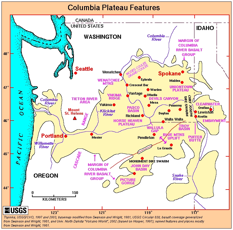
The post for Friday, August 26, 2016 included the first mention in this blog of the largest earthquake which occurred in the state of Washington. This quake occurred on December 14, 1872 at about 9:40 PM. This quake was again mentioned in posts for Monday, August 29, 2016 and Friday, September 2, 2016. Current estimates for the size of this major quake run as high as M7.5. But there was another big earthquake in 1872, which should be noted. It also was a massive quake in at least the M7.0+ range. This one occurred in southern California at Lone Pine, approximately 9 months before the Washington event. At this point, a question should be asked. Could there be any connection between these two major quakes via transferred stress or some other geologic phenomenon? Keep this question in mind as we explore that other, massive earthquake of 1872.

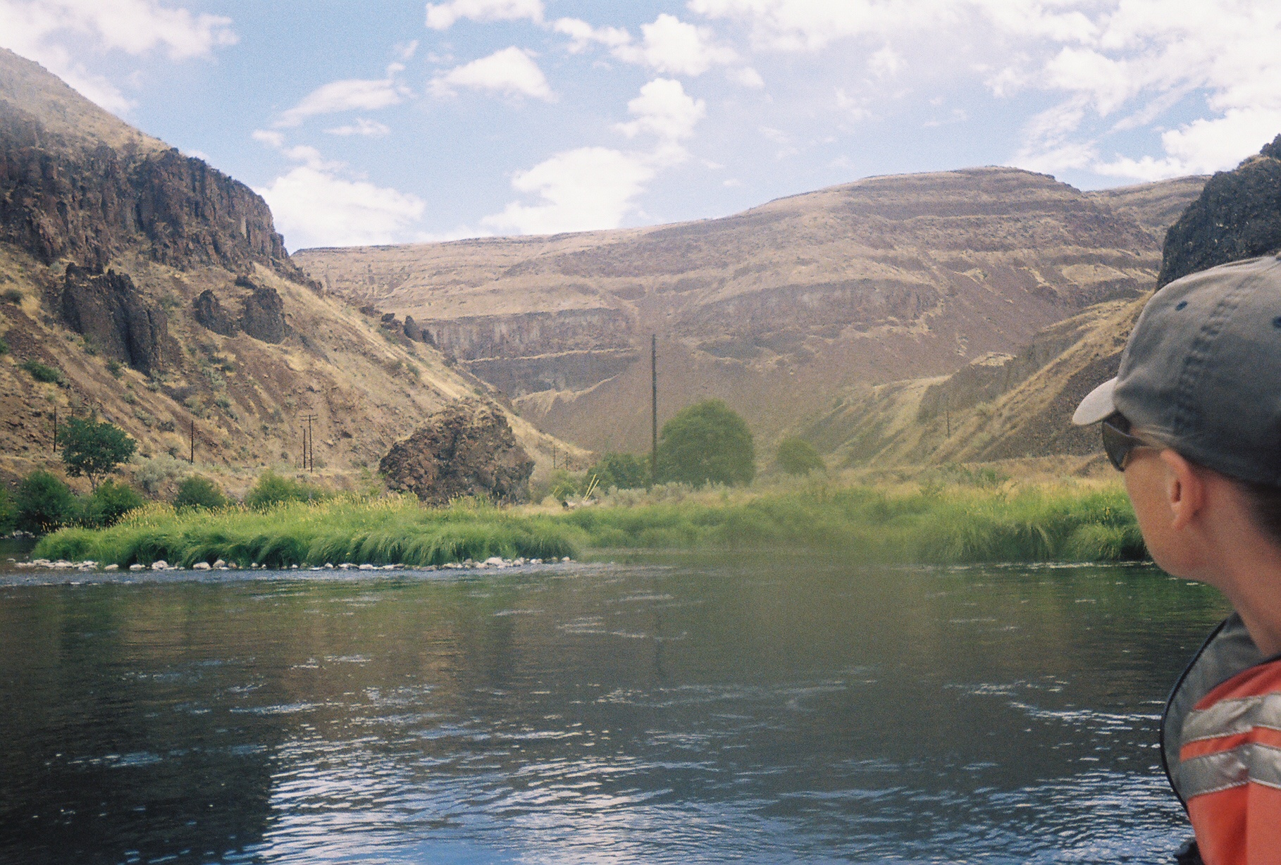
The Lone Pine earthquake of 1872 (also called the Owens Valley earthquake) struck on March 26 in the north-northwest to south-southeast trending Owens Valley, which lies east of the Sierra Nevada. This quake had an estimated magnitude of 7.4 to 7.9 (link). It was one of the largest quakes California has ever experienced in recorded history. In this quake, the ground also did something strange. It suddenly moved vertically a distance of 15 to 20 feet. Another source, linked here, states: "Vertical displacement was measured at nearly 17 feet." Furthermore, according to the Wikipedia entry (first link above), things to the west of the Lone Pine Fault moved northward for a distance of approximately 35 to 40 feet. In this quake, a good share of the buildings in the local area were utterly destroyed.

A page, linked here, presents information from the April 4, 1872 issue of the Colorado Chieftain of Pueblo, Colorado and an issue of the Sterling Standard of Sterling, Illinois -- of the same date. It declares: "Stage passengers report that several fissures, miles in length and fifty to two hundred feet wide and twenty feet deep, opened along the eastern base of the Sierra Nevada. Near Big Pine Camp, and at other places in the vicinity, the ground was heaved up in great ridges." Further down, the page states: "A chasm was opened extending 85 miles down the valley, and ranging from three inches to forty feet in width." On the second page of the link is something very interesting. It states: "Indians in the vicinity have all left, fearing a recurrence of a general convulsion of nature, which according to tradition, occurred there some hundred years ago, and created what is now known as Owen's River Valley, but what was before a chain of mountains."

What is this which is recorded above? The Indians local to the Owens Valley have a tradition about a massive earthquake somewhere in the not-too-distant past which created the Owen's River Valley out of what was formerly a chain of mountains. What could cause such large-scale faulting and relatively swift sinking of land in the midst of a chain of mountains? Keep these thoughts in the back of your mind as we continue looking at other things.

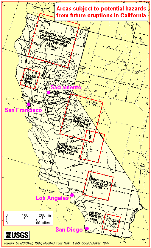
The 1872 California earthquake was felt from Mexico to Oregon (link). The early morning quake was so powerful that adobe buildings 400 miles north of the epicenter, in Red Bluff, collapsed (link). A page, linked here, states that this "massive earthquake on the fault shook the West from San Diego to Salt Lake City. At the bottom of a USGS page, linked here, is a picture of a 23-foot-high fault scarp in the Owens Valley, which was caused by the ground sinking during the 1872 quake. What caused this rather sudden sinking in the valley?

According to a Live Science webpage, linked here, there is something very unique about the 1872 Owens Valley quake. The page states: "The Owens Valley fault broke along 70 miles (113 kilometers) of fault, less than one-half to one-third of the sections ruptured by the San Andreas Fault's biggest earthquakes." The page continues: "Despite its short length, the Owens Valley quake seemed to have very energetic shaking." The page states that "in Eastern California, big earthquakes seem to link up several smaller faults when they strike, instead of staying on one fault." For those in the Pacific Northwest, this is a phenomenon which is worth keeping in mind regarding the coming Cascadia megaquake event. Faults can "link up" and produce a much bigger quake than is currently expected.

An abstract from a 2009 issue of the Bulletin of the Seismological Society of America (BSSA), linked here, states that the preferred magnitude estimate for the 1872 Owens Valley earthquake is 7.8 to 7.9. The page then states: "The results of our study suggest that either the Owens Valley earthquake was larger than the 1906 San Francisco earthquake or that, by virtue of source properties and/or propagation effects, it produced systematically higher ground motions at regional distances. The latter possibility implies that some large earthquakes in California will generate significantly larger ground motions than San Andreas fault events of comparable magnitude." This gives some food for thought.

In the BSSA abstract, linked above, is something else which should be noted. It declares: "Macroseismic observations thus suggest a magnitude greater than that of the 1906 San Francisco earthquake, which appears to be at odds with geological observations." Macroseismic observations take into account more than just the observations of seismologists. Macroseismic observations also take into account the observations of engineers (link).

The seismologists may say, "The geologic evidence shows the quake could only have been this particular size," while the engineers can say, "But it takes this much shaking to destroy this type of structure." So, macroseismic observation could possibly produce a more accurate picture of a quake event than seismology alone. At this point, there is something to consider. In true science, we must look at all the facts.

The BSSA abstract, linked further above, is associated with a much larger study. The complete 42 page study which is associated with the above abstract is linked here. It is a good read for those desiring more detailed information about how scientists have viewed the Owens Valley quake.

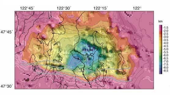
The 42 page study, linked above, on PDF page 8 of 42 notes that "the Owens Valley is [a] major structural depression. The study indicates, on PDF page 14 of 42, that the hypocenter depth for the 1872 quake may have been somewhere in a range of 15 km to 25 km below the surface. This appears to be getting down somewhere relatively near to "the basement" of the continental crust in this region. On PDF page 18 of 42 is another piece of information to note. It states that "a more shallow seismogenic zone would of course reduce the maximum magnitude that a given fault could generate." This would tend to indicate that a deeper seismogenic zone would increase the maximum magnitude that a given fault could generate. This is another thing to keep in mind regarding the Cascadia region and its unique network of faults and rifts. Looking further, the study states on PDF page 19 of 42 that earthquake "events with magnitudes approaching 8 are not restricted to the San Andreas fault, but can occur over much if not quite all of California." This does not bode well for Californians.

A 1894 edition of the Annual Publication of the Historical Society of Southern California, linked here, presents some very detailed information about things which happened during the 1872 Owens Valley earthquake. (NOTE - Turn pages via arrows at top or bottom of pages. Six pages total.) The entry begins with a picture of a very peaceful night in 1872. Then it declares: "In an instant, without any warning symptoms from the heavens above or the earth beneath, the mountains were swaying like storm-tossed trees and the valley rolled like the sea." It continues: "About 25 minutes past 2 o'clock in the morning great rumbling and roaring were heard to come from deep in the earth. At the same instant the ground rolled violently; there was also a twisting motion, and this, together with the heaving and rolling, produced great and instant destruction."

The 1894 publication, linked above on page 31 of 32, declares: "That the center of this great disturbance of the earth was deep-seated is evident from the permanent changes on the surface. About twenty-eight miles north from Lone Pine the bed of Owens River sank, making a depression that took the river several hours to fill up. This depression still remains, a lake of some hundreds of acres in extent." The page continues: "About seven miles north of Lone Pine the ground sank toward the west; the river followed this depression and made a new channel, in which it continues to flow. The high banks of the old channel can yet be seen about two miles to the east from the present west bank of the river, at a point four miles north of Lone Pine." This is quite an event to think about. It does present food for though for people in the Cascadia region, especially when considering the coming Cascadia megaquake event. Things can change, geologically, very quickly. Large areas of land can sink and waterways can be changed -- in a moment.

Looking further, an abstract, linked here, declares: "The Owens Valley fault zone apparently accommodates some of the relative motion (dextral shear) between the North American and Pacific plates along a discrete structure. This shear occurs in the Walker Lane belt of strike-slip and normal faults within the mainly extensional Basin and Range Province. In Owens Valley, the displacement is partitioned between the Owens Valley fault zone and the nearby, subparallel, and purely normal range-front faults of the Sierra Nevada."

Look, once again, at what is stated in the paragraph above. The Owens Valley fault zone and the Walker Lane belt of faults appear to be a point of movement between the North American and Pacific plates. Things on the west side of this valley are moving northward, compared to things on the east side of the valley. This movement is said to occur along a "discrete structure." What is this discrete structure?

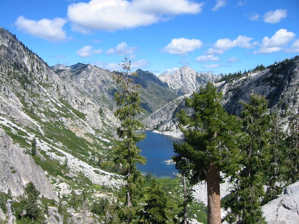
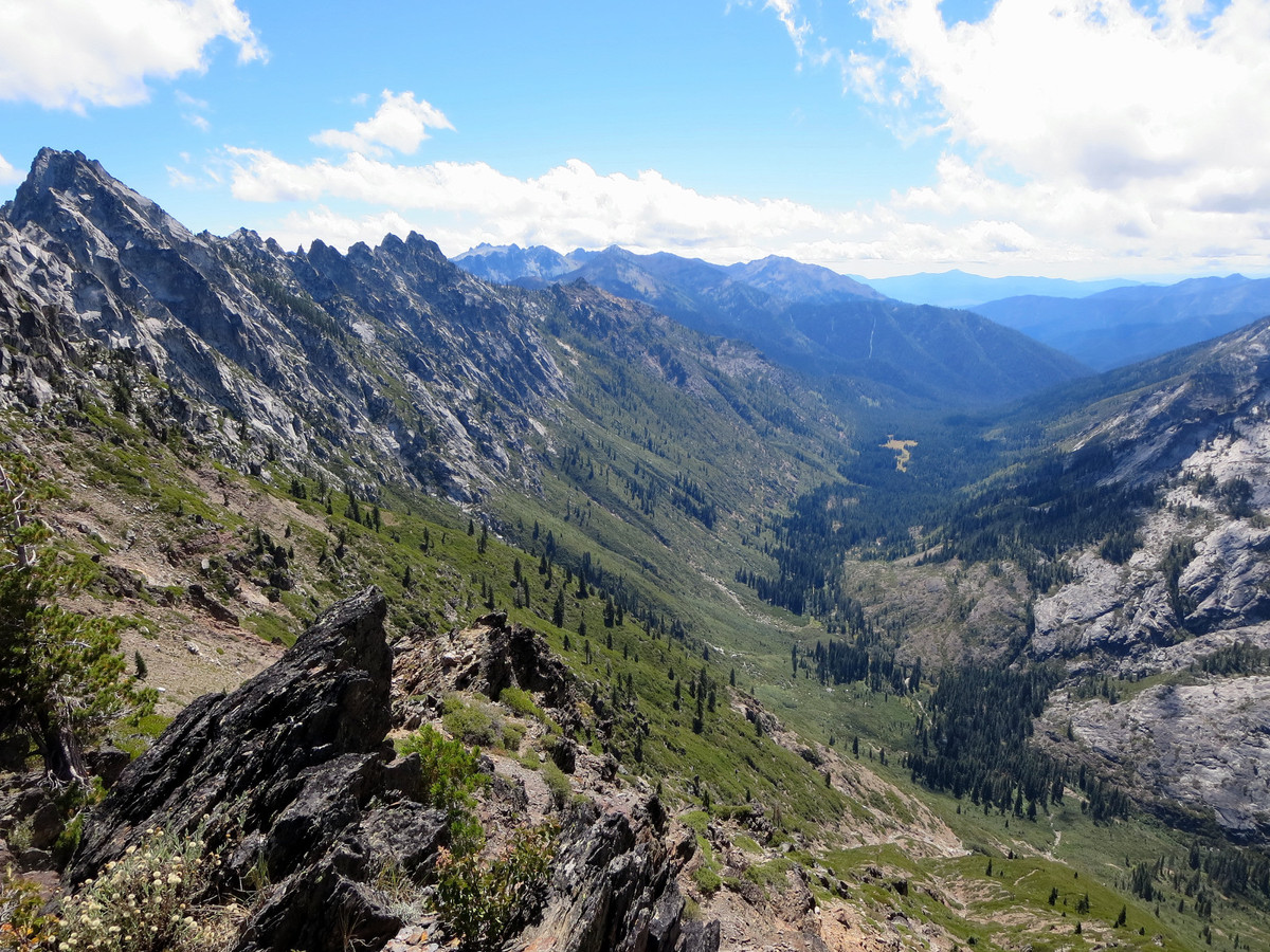
A Wikipedia entry, linked here, declares: "Owens Valley is a graben -- a downdropped block of land between two vertical faults... It is also part of a trough which extends from Oregon to Death Valley called the Walker Lane." The Wikipedia entry states that "this graben was formed by a long series of earthquakes..." Could this have anything to do with the Indian tradition about "a general convulsion of nature," a massive earthquake event in earlier times which rapidly formed the Owens River Valley in the midst of a chain of mountains? What happened to cause or allow the land to drop such a great distance? What are we truly dealing with here?

A webpage, linked here, states: "Continental rift zones are typically made up by a series of asymmetric graben..." Note, again, the word "graben." A Wikipedia entry, linked here, declares: "Typical rift features are a central linear downfaulted depression, called a graben, or more commonly a half-graben with normal faulting and rift-flank uplifts mainly on one side... The axis of the rift area may contain volcanic rocks, and active volcanism is a part of many, but not all active rift systems... Many rifts are the sites of at least minor magmatic activity, particularly in the early stages of rifting." This information does give us some food for thought, especially when considering the volcanic centers in the Owens Valley.

A page on the Caltech website, linked here, declares: "Owens Valley is a nearly perfect rift valley, a divergent boundary in which both sides are moving apart. Many geologic and hydrologic features, which are characteristic of rift valleys, are evident in Owens Valley, including normal faulting, volcanism, and geothermal hot springs, to name a few."

A webpage, linked here, declares: "The Owens Valley is a classic 'graben' formed by extensional forces pulling the western regions of California and Oregon westward away from the interior of North America." So, as extensional forces tug on the landmass, stretching it, things finally crack. When a chain of mountains is pulled apart during this spreading, the unsupported land between the cracks can sink rather suddenly. A scenario like this adds credibility to the tradition of Indians in the Owens Valley area about "a general convulsion of nature," which, in earlier times "created what is now known as Owen's River Valley" out of "what was before a chain of mountains."

A 73-page USGS document titled Structural Geology and Volcanism of Owens Valley Region, California - A Geophysical Study, is linked here. On PDF page 6 of 73 are found the following words: "Owens Valley is a downdropped block, or graben, between the Sierra Nevada and the White and Inyo Mountains." The USGS document states further, on PDF page 6 of 73: "The association of volcanic rocks with the depressions of Long Valley and Mono Basin suggests that these structural features may have been created in part by volcano-tectonic processes." So, we appear to be looking at a combination of volcanic and tectonic processes in the making of this unique region. Yes, the moving of plates, or the rifting of the landmass, with associated volcanism.

The USGS document, linked above, contains even further statements of interest. On PDF page 11 of 73, it states: "Owens Valley is a structural trough that has been dropped down as a graben along normal faults that separate it from the Sierra Nevada on the west and from the White and Inyo Mountains on the east." On PDF page 60 of 73, the document states that the "Owens Valley seems to lie near the crest of a great arch that has been broken by block faulting. As the crest of the arch broke, perhaps during general uplift of the Sierra Nevada and of the extreme western Great Basin, Owens Valley seemingly subsided as a graben."

Wow! Once again, the USGS information above hints a little at the Indian tradition, noted further above, about "a general convulsion of nature." When rifting is being initiated and the land is "stretched," when things suddenly snap, the unsupported land can sink rather suddenly. Nature proves this fact over and over again when areas on steep-sided mountains suddenly break loose and come crashing down. In the case of Owens Valley, it was similar to fractures on steep-sided mountains, except in this case, being fractures going deep into the landmass. When things "snapped," it is possible that the valley was formed rather rapidly, just like Indian tradition indicates.

Once again, noted further above and linked here, is an abstract which declares: "The Owens Valley fault zone apparently accommodates some of the relative motion (dextral shear) between the North American and Pacific plates along a discrete structure. This shear occurs in the Walker Lane belt of strike-slip and normal faults within the mainly extensional Basin and Range Province. Again, a Wikipedia entry, linked here, declares: "Owens Valley is a graben -- a downdropped block of land between two vertical faults... It is also part of a trough which extends from Oregon to Death Valley called the Walker Lane." What is this Walker Lane all about -- this geologic trough which "extends from Oregon to Death Valley?"

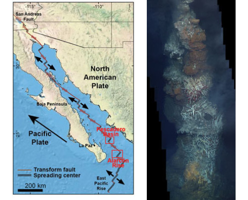
A page, linked here, is titled The Walker Lane RIFT SYSTEM: A Natural Laboratory to Study Rift Initiation that Culminated in Seafloor Spreading (in the Gulf of California). PDF page 3 of 25 declares: "Walker Lane rift system - currently accommodates 20-25% of the plate motion between the Pacific and the North American plates..." From what is stated on the page, it appears we are, in the Walker Lane, looking at continental rifting. On PDF page 25 of 25 of the document, it notes "the successful Gulf of CA rift" and the "rift initiation in the Walker Lane," plus an "interface with Cascadia." What, yes once again, WHAT is being dealt with in the coastal states of North America? Hold this thought for a few more moments.

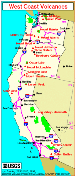
Another page, linked here, is titled Siting of Large Volcanic Centers at Releasing Fault Stepovers, Walker Lane Rift. On PDF page 4 of 54, it speaks of the Walker Lane Belt as being "like [the] Gulf of California, but no sea floor spreading yet." Note very closely, once again, the use of the word "YET," and then finish looking through the document. On PDF page 8 of 54, it is noted that the "Gulf of California rifting was unusually FAST." PDF page 11 of 54 speaks of "large volcanic centers in transtensional pull-aparts along the eastern margin of the Sierra Nevada." In effect, these would be similar to the short spreading centers, sandwiched between the transform faults in the bottom of the Gulf of California.

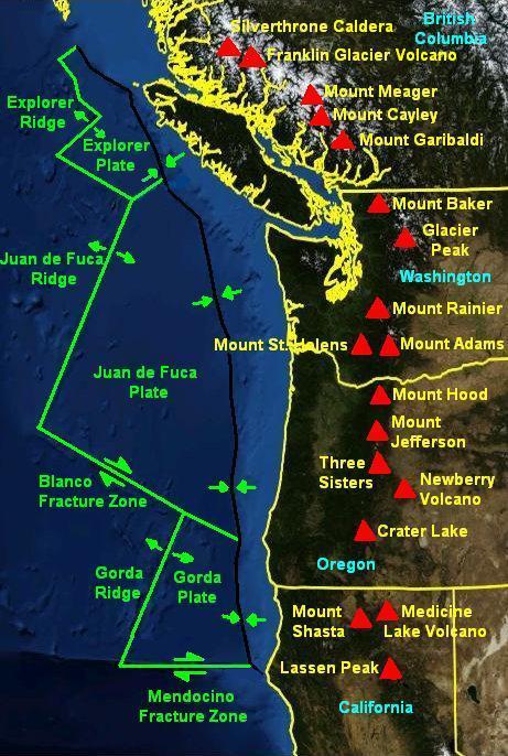
In the document linked in the preceding paragraph, on PDF page 15 of 54, is noted how "the northern Walker Lane increasingly interacted with the Cascade subduction zone to produce transtensional environments favorable to the development of major volcanic centers." So, it is very clear -- we are dealing with a rift -- a process where the continent is rifting or pulling apart. And this rifting or pulling apart has links to the Cascadia region. So, what kind of seismic activity can we expect from all this in the Cascadia region, in the times ahead?

At this point, let us remember the two major earthquakes in 1872 -- the first in the Owens Valley, and then about 9 months later, the massive earthquake in Washington. Seeing that rifting in the Owens Valley and the Walker Lane is associated geologically with Cascadia, there is a question to ask. When the massive Cascadia megaquake occurs, will it have been preceded by a massive quake somewhere along the trough of the Walker Lane? In other words, will a massive quake in southern California be like an advanced warning system? Will it give the warning so citizens of the Pacific Northwest can then be watching for more localized signs -- signs which may help indicate more closely when the devastating Cascadia event is about to occur?

By the way, what appears to be controlling or associated with this large-scale continental rifting? Once again we must look at the Gulf of California, and the Gulf of California Rift Zone. A Wikipedia entry, linked here, declares: "The Gulf of California Rift Zone (GCRZ) is the northernmost extension of the East Pacific Rise which extends some 1300 km from the mouth of the Gulf of California to the southern terminus of the San Andreas Fault at the Salton Sink." But, after considering all the information presented in this discussion, we now know the rest of the story.

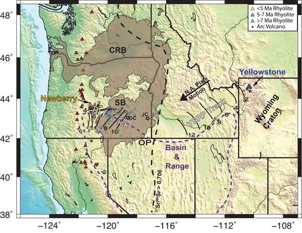
The oceanic rift system, when it burrows into the North American continent, does not follow the San Andreas Fault back out to sea again, north of San Francisco, California. Instead, the ancient oceanic rift (which was over-ridden by the westward moving North American continent) ended up far down at the basement of the continent, somewhere far inland. Generally, it is situated below the Owens Valley graben and the Walker Lane. It extends all the way to the Cascade Mountains in southern Oregon. From there, it appears that this now deeply buried oceanic rift generally follows the line of the Cascade Mountain volcanoes.

Once again, it appears that the ancient, now deeply buried oceanic rift system is that which is controlling the rifting in the continental landmass above it. It appears that this ancient rift system may also be a major initiator of earthquakes in the Pacific states. Now you know more about what is happening, geologically, on the West Coast of the United States. Now you can better understand what the future may hold, even in the Cascadia region. And remember, things can change really fast in life, even in the geology of the Pacific states. The writer wishes you all the best in the times ahead.


For further reading:

Current Expectations for a Cascadia Mega-Quake
https://cascadian.neocities.org/cascadiaquake.htm


Friday, September 9, 2016

Rift Zones and Volcanoes, plus the Pacific Coast

Let us now discuss just a bit further about that ancient rift, which is noted in the previous post from Wednesday, August 7, 2016. After this, the writer will do his best to refrain from further posts dedicated to this deeply buried rift. Let us begin this discussion by looking at information about rift systems in general.

A Wikipedia entry on Rifts, linked here, declares: "In geology, a rift is a linear zone where the Earth's crust and lithosphere are being pulled apart and is an example of extensional tectonics." The entry also declares: "The axis of the rift area may contain volcanic rocks, and active volcanism is a part of many, but not all active rift systems." As we continue through this discussion, keep in mind that "active volcanism is a part of many" rift systems. Considering this matter further, volcanism, in many cases, appears to be associated with extensional tectonics in rift systems, or where things are obviously weakening and spreading below the surface of the ground.

A map, linked here, gives a general illustration of the worldwide, mid-ocean ridge and rift system. Toward the center of the map is found the portion of the ridge and rift system called the "East Pacific Rise." Note that this oceanic rift system burrows into the mainland of North America at the northern end of the Gulf of California. This is shown clearly on a map, linked here.

A webpage (with illustrations), linked here, declares: "The Gulf of California sits at the northernmost end of an immense underwater mountain range called the East Pacific Rise, which extends across the Southeastern Pacific Ocean almost to Antarctica. Along much of this mountain range, lava wells up from below, causing the Earth's crust to split apart, and forming what geologists call 'spreading centers.'" From what is said on the page, it appears that volcanic activity is often associated with these "active spreading centers." As a side note, the page mentions a cause for transform faults which are associated with these spreading centers.

The page, linked above, declares that "the East Pacific Rise is a 'divergent' plate boundary, where huge slabs of the Earth's crust (plates) are moving away from each other." It states further that "near the Gulf of California, the relative motion of the plates changes so that the two plates (the North American Plate and the Pacific Plate) are moving sideways, sliding past one another." It is important to note that between the areas where the plates are sliding sideways past each other, there are short sections in which things are spreading apart. These are basically more localized spreading centers.

Looking further at the page linked above, it speaks of lava welling up from below. It appears this welling up of lava occurs at the spreading centers. Therefore, it is reasonable to believe that a line of volcanoes across a given region tells a story about the geology deep underground, plus indicates where there may be spreading centers, even localized spreading centers, on a given rift system. Let us now consider this matter further.

An obvious line of volcanoes appears to indicate a zone of weakness or rifting. Looking at evidence elsewhere on this earth, one example of rifting and an association with volcanoes is the East African Rift. Information about this rift is found on a Wikipedia page, linked here. This Wikipedia page includes a basic map of the rift and "some of the historically active volcanoes" which are spaced along it. The map also shows volcanoes spaced along a rift in the Red Sea. Yes, an obvious line of volcanoes does appear to tell a story about rifting, or the separation of plates, which may be happening in association with a continental landmass.

A general map, linked here, shows volcanic provinces associated with the East African Rift and the rifting in the Red Sea. Another map, linked here, notes the general location of volcanoes along the zones of rifting. In the examples noted, it appears that there is a clear association between rift zones and lines of volcanoes.

Let us now get back to the subject of an oceanic rift system which burrows into North America at the northern end of the Gulf of California. Again, let us remember that volcanoes can be associated with spreading centers and can mark the location of a rift system below the surface of the ground. So, let us trace the line of many volcanoes northward across the landmass from the tip of the Gulf of California, all the way to the U.S. border in northern Washington.

The first volcano on land, at the northern tip of the Gulf of California, appears to be Cerro Prieto. A Wikipedia entry, linked here, notes that this volcano is located about 18 miles south-southeast of Mexicali, Mexico. The entry declares further: "The volcano lies astride a spreading center associated with the East Pacific Rise. This spreading center is also responsible for a large geothermal field which has been harnessed to generate electric power by the Cerro Prieto Geothermal Power Station." Considering this information, it is clearly seen that isolated spreading centers, located between sections of transform faults on this system which penetrates the continental landmass, can host volcanoes.

A map, linked here, notes the location of Cerro Prieto, in Mexico. Looking further north into the United States, the map notes the location of Salton Buttes. Regarding Salton Buttes, a Wikipedia entry, linked here, declares that "They are the only active volcanoes in Southern California, and are associated with the East Pacific Rise." So, where does the now deeply buried East Pacific Rise, with its isolated spreading centers and volcanoes, go from here?

A space shuttle photo of southern California, looking in a northwesterly direction, is linked here. A line indicating the San Andreas fault is superimposed on this photo. Look at how the San Andreas takes off sharply to the west from the area of the Salton Sea. Then near Los Angeles, the fault takes a sharp turn to the north. Since we are considering rift systems, spreading centers and volcanoes, let us look at what another page states.

A webpage, linked here, states: "A volcano is an opening in the earth's crust that allows molten rock from the mantle to flow out onto the surface as lava." But, when considering volcanoes, there is something to note about the San Andreas Fault (SAF) system. The page states: "The SAF is a transform plate boundary (strike slip fault) and so is not accompanied by volcanic activity." So, if the San Andreas fault system does not host volcanic activity, where must we look to find those deeply buried, isolated spreading centers along the concealed, ancient rift system -- that north-trending rift system which was discussed in the previous post from Wednesday, September 7, 2016?

For a moment, let us diverge from the matter of that deeply buried, north-trending rift system. There appears to be a very logical explanation for the San Andreas fault system, which is not associated with the path of the below-continent rift system. Information relating to this matter may be discussed in a later post. Now, back to our search for a logical path for the buried rift system.

In the space shuttle photo of southern California, linked further above, there is something which is worth noting. From the Salton Sea, a more direct path for the now deeply buried remnants of the East Pacific Rise and its associated spreading centers would be to the east of the Sierra Nevada. Let us now consider if there are any indications that this could be the actual path of this buried rift.

A map, linked here, is titled 'Volcanoes and Volcanic Areas of California.' Note that almost all the volcanoes in California are in a line along the eastern side of California -- in that area which sits to the east of the Sierra Nevada. Another map, linked here, is titled 'Areas subject to potential hazards from future eruptions in California.' Note once again that the bulk of this predicted volcanic activity is in the eastern part of California, to the east of the Sierra Nevada. To the writer, this indicates a line of isolated spreading centers, which are located below the surface of the ground in eastern California.

In the western United States, the major line of volcanic activity extending northward from the Gulf of California generally follows the eastern side of California. The line then intersects with Lassen Peak and Mount Shasta. From that point, the line continues northward in Oregon and Washington along the volcanoes of the Cascade Mountains. This line of volcanoes, which extends into Canada, is clearly shown on a map linked here.

Once again, there is only one statement which can reasonably be made. When things really cut loose in the Cascadia region, and possibly even in California, then many questions about this ancient, deeply buried rift will hopefully be answered.


For further reading:

Current Expectations for a Cascadia Mega-Quake
https://cascadian.neocities.org/cascadiaquake.htm


Wednesday, September 7, 2016

Considering the Location of an Ancient Rift

This post simply presents some food for thought. The discussion will start with a look at the Klamath Mountains of southwest Oregon and northwest California. The general location of these mountains is noted on maps at the following links: (1) (2).

The Klamath Mountains is an area with a very unique geology (3), compared to the remainder of California and Oregon. It is an area of very rugged mountains and other interesting geologic features. In support of these statements, just take some time to scan through photos from the Klamath Mountains region, which are found on the Internet at the following links: (4) (5) (6) (7) (8) (9) (10) (11) (12) (13) (14) (15) (16) (17) (18) (19) (20) (21) (22) (23) (24) (25).

The Klamath Mountains are unique in a special way. They were not originally part of the ancient North American continent. Regarding the Klamath Mountains, a page from Oregon Magazine, linked here, states things very simply in this manner: "A series of metamorphic and igneous mountain chains formed as islands and then collided with North America..." By looking at a map, linked here, it becomes clear that in the ancient collision with North America, the islands which now form the Klamath Mountains were embedded deeply into the continental landmass, all the way to the Cascade Mountains.

At this point, there is a question to consider. Where were the original islands formed and located, which now make up the Klamath Mountains? From his research, the writer has reason to believe that these islands were formed at the ancient mid-ocean ridge and rift system which formerly lay west of ancient North America. The Klamaths appear to have been islands on top of the rift system, just as Iceland is an island on top of a mid-ocean ridge and rift system in the Atlantic Ocean (link).

In the case of the Klamaths, during the collision with North America as the continent moved westward, the islands were mashed deeply into the larger landmass. Because of the nature of this collision and the compression involved, any rift line which originally may have passed through these islands may be much less obvious. At this point, there is a question to consider. Where then would the ancient mid-ocean rift system now be located, in relation to the continental landmass, after the collision and embedding process?

At this point, there is something to note. Far to the south, the oceanic ridge and rift system lies in the bottom of the Gulf of California, between the peninsula of Baja California and the mainland of Mexico. This is shown in a map, linked here. A map, linked here, notes the area of the 'Gulf of California Rift Zone' in the Salton Trough of southern California. From this region northward, it appears that the rift is located under the continental landmass of the United States...somewhere, deep under the states of California, Oregon and Washington. Should not the embedded location of the ancient islands, which now form the Klamath Mountains, give us some indication of the present location for this deeply buried ancient rift?

It is commonly taught that the San Andreas Fault represents the path of the oceanic rift, as it passes in a northerly direction through the landmass and back out to sea not far from San Francisco, California. This is shown on a map linked here. But there may be more to consider here. The writer has reason to believe that the San Andreas represents a more surface-type of fault, with the ancient oceanic rift being much deeper and following a different path.

On a USGS map, linked here, it should be noted that the Salton Buttes in southern California are classed among the "high threat volcanoes." Moving northward in a line, there are more volcanic features which form the Ubehebe Craters and the Long Valley Caldera. Along the north-trending line are also located the volcanoes of Lassen Peak and Mount Shasta. Mount Shasta is in the Cascade Range and located further inland from those now embedded islands which form the Klamath Mountains.

It is now time for some food for thought. Would it not be logical to suspect that the ancient rift upon which the "islands" of the Klamath Mountains resided, when looking at the California portion of this rift, would generally follow the line of volcanoes to the east of the Sierra Nevada? Isn't it rather common on this earth to have rift lines "feeding" a line of volcanoes?

The volcanic line to the east of the Sierra Nevada continues northward toward Mount Shasta. From there, it heads northward along the volcanoes of the Cascade Mountains in Oregon and Washington. This main track of volcanoes through California, Oregon and Washington can readily be observed on a USGS map, linked here.

The bottom line is this: When things really break loose on the West Coast of North America, we may all know, without any remaining questions, where the true path of the deeply buried, ancient rift has been located for quite a period of time.


For further reading:

Current Expectations for a Cascadia Mega-Quake
https://cascadian.neocities.org/cascadiaquake.htm


Monday, September 5, 2016

Continental Rifting and Eastern Washington

An article in the Spokane Daily Chronicle of December 17, 1981, linked here, speaks about a giant rift which extends across the continental United States. It extends from north central Georgia, on its eastern end, to at least the Spokane, Washington area, on its western end. The article notes that this potential split in the continent "might end near Spokane." But, there appears to be much more to this story.

The 1981 article, linked above, states that there will need to be more research to prove whether or not this giant rift, "just discovered with space-age technology, actually extends into Washington." Regarding this giant rift and other fault systems from Idaho, it appears that geologists are having trouble tracing them into the state of Washington, "although they may exist." Why are they having this problem tracing fault systems into Washington? It is "because of alluvial deposits and the basalt covering over older rocks west of Spokane." In other words, the fault systems are deeply buried, with possibly no clear signs of their existence on the surface.

At this point, there is a comment to make. Look at the map in the linked news article. It shows the general location of this major rift system. Look where the western end is shown in Washington. Now, let us note a particular statement in the article. Regarding this rift, one geologist stated that "it apparently hasn't caused any trouble." A USGS geologist indicated that this giant continental rift "could be associated with earthquake disturbances in some parts of the country, [but] apparently hasn't affected Spokane that way."

At this point, there is a thought to keep in the back of our minds. What about that large, unexplained earthquake which occurred in Washington in 1872? Yes, just hang onto that thought. Getting back to the article, it notes that this giant rift "is 90 miles across at its widest and extends deep into the earth's crust, but poses no danger." Note the statement about posing "no danger." We will, further down in this discussion, see how thinking has changed somewhat over the years.

Another article from 1981, this one from the Nevada Daily Mail of December 16, linked here, speaks about this cross-continent rift as being a "rift, or series or [sic] rifts." A correction of the preceding sentence may be a "rift, or series of rifts." There is something to note at this time in the article. This rift system "lines up perfectly with other topographical features." And, what are some of these other topographical features?

A PDF document from the NASA website, linked here, speaks about this rift system (a linear gravity low), which is "aligned with the Lewis and Clark lineament (Montana to Washington), forming a linear feature of approximately 2800 km in length." Of the cross-continent "gravity low," the linked document states: "The origin of the linear gravity feature is problematical - it may be a rift, a transcurrent fault, or some combination." The document also states: "Perhaps the most plausible explanation is that the gravity low may be as part of an extensive transcurrent fault system or a failed continental rift."

A July 2016 webpage, linked here, contains some interesting information. It declares: "In Nov 1981, a study was published that rocked the scientific world, and sparked concern in FEMA circles..." That report turns out to be the NASA document linked in the preceding paragraph. The linked page then states: "New discoveries, from more recent research, has extended this 'Crack' anomaly in where it combines with a MegaShear zone to the middle of Washington State and possibly with the Olympic-Wallowa Lineament (OWL) – which reaches to the Pacific Ocean near Port Angeles Washington. Thus the total length may total nearly 2,200 miles."

It is now time to consider a particular statement made in 1981 news articles, linked further above, about the giant rift posing no danger. The page linked in the preceding paragraph declares: "What is known, is that these linear rift zones have exhibited the ability to unleash very large earthquakes." It also appears that "scientists are unable to identify if any section of these linear rift zones may be at risk of a sudden large earthquake." The information presented thus far in this discussion should now give us some food for thought.

This ancient, cross-continent rift system, on its Washington end, appears to reside in older rocks which presently are buried deeply beneath thick alluvial deposits and thick layers of basalt in areas to the west of Spokane, Washington. The NASA document indicates that this deeply buried rift system may be associated with the Lewis and Clark lineament. The page linked in the preceding paragraph talks about "more recent research" which links the cross-continent rift "with a Megashear zone to the middle of Washington State and possibly with the Olympic-Wallowa Lineament..." It is now time for a question. Could this deeply buried rift system have been instrumental in Washington's largest recorded earthquake, in 1872?


For further reading:

Current Expectations for a Cascadia Mega-Quake
https://cascadian.neocities.org/cascadiaquake.htm