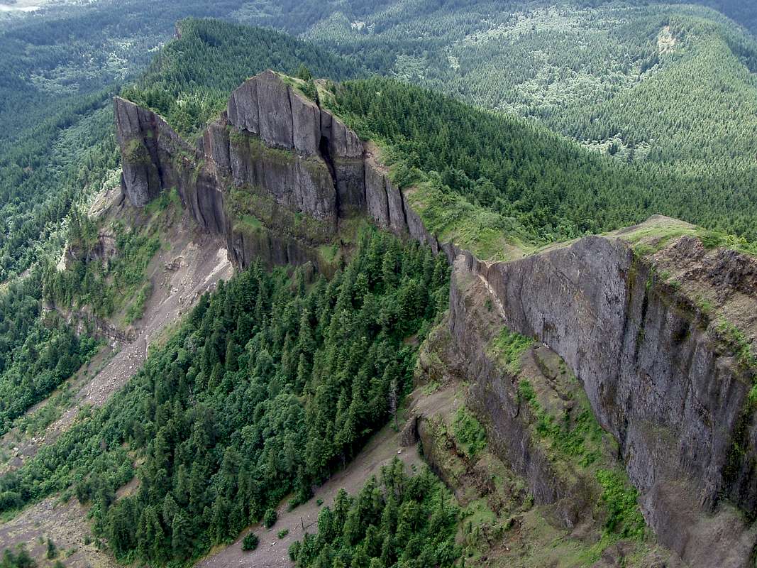
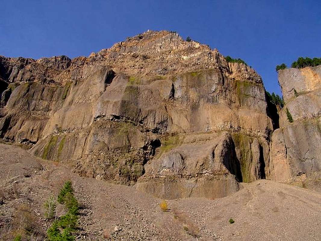
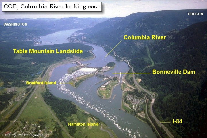
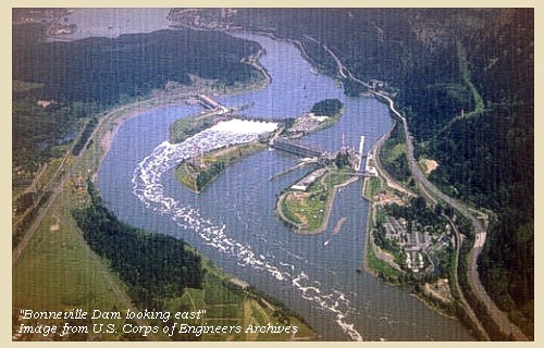
Some time in the past, something caused a large portion of a mountain, made of solid rock, to split off and tumble down, forming a large landslide which dammed the Columbia River for an extended period of time. This landslide occurred in the area where Cascade Locks, Oregon and Bonneville Dam are now located. Pictures which show the remaining face of this mountain, from which the massive amount of slide debris came, can be seen at the following links: (1) (2) (3) (4) (5). Views of the landslide can be seen in photos at the following links: (6) (7) (8) (9 - on PDF page 1 of 24).
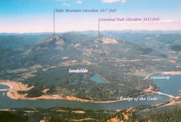
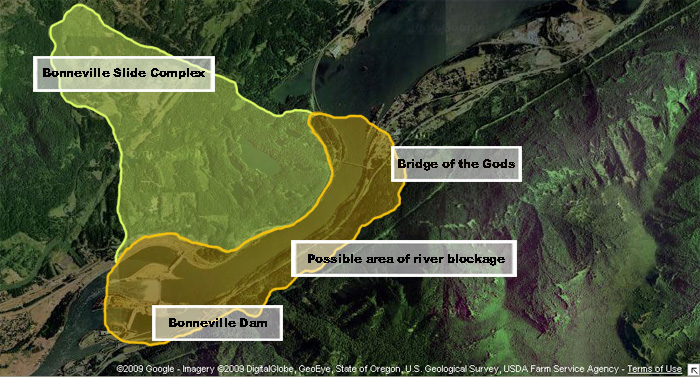
The fracture line on Table Mountain, which is linked to the Bonneville slide, generally is aligned from south-southwest to north-northeast, as can be seen in an aerial photo linked here. The debris from the mountain generally slid in a southeast direction, as can be seen in overlays on aerial photos, linked here and here. Photos of the face of Table Mountain and the Bonneville slide work together to tell an important story about events in the past which created the Bonneville Landslide Complex. These events should have extreme importance to us of this day, especially for those who live in the Cascadia earthquake zone.
Closely examine photos which include the massive Bonneville Landslide (Table Mountain Landslide is part of the complex), which are located at the following links: (10) (11) (12) (13) (14). Take some time studying closely the photo in link number 14. There are a lot of important things which can be learned from all of these photos, especially when considering that the debris for this massive slide-complex came from tall mountains of solid rock.
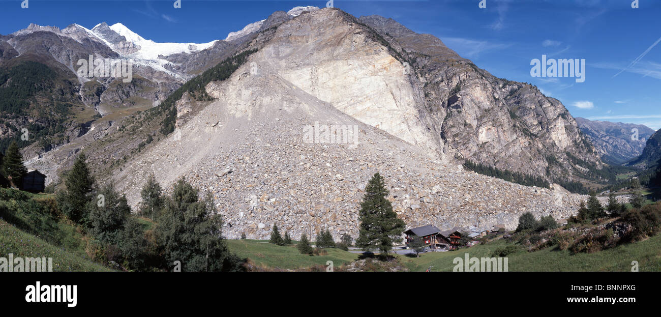
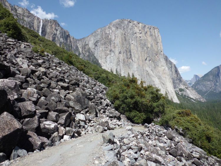
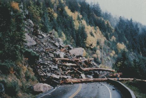
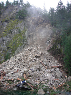
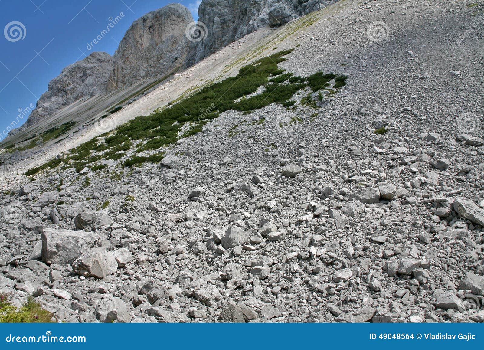
To learn the lessons which are told by the Bonneville Landslide Complex, we should first examine photos of normal rock slides from mountains to use as a comparison. Photos of normal rock slides from mountains are found at the following links: (15) (16) (17) (18) (19) (20) (21) (22). What can be learned from the preceding photos? Yes, normal rock slides from mountains generally slope downwards at a fairly steep angle.
Look once again at all the photos of the Bonneville slide. Look especially at the one in link number 14. In these photos, there are two important things to note. First, look at the distance this slide traveled, until it met the steep mountains on the Oregon side of the Columbia River. This was quite a distance, something which, in this instance, is unusual in this rock slide, especially one from mountains made of solid rock. But there is something even more important to note in these photos. Note the extreme shallow angle in the Bonneville slide, which can be seen the best in the photo in link number 14, above. What do these two factors, the distance the slide traveled and the shallow angle of the slide, have to tell us about what logically would have caused this massive slide?
The two factors, distance and angle, tell the writer that massive, long duration earthquakes were involved in the creation of the Bonneville Slide Complex. The initial slides from the mountains would have been steeply sloped. But intense shaking of a long duration would have caused the debris to keep moving outward and to spread out for a long distance. Intense shaking for a long duration would also leave a very shallow slope to the final debris field, as things shook greatly and sought a level state. It appears that this would be the most logical conclusion. Looking again at the general alignment of the shear cliffs on the rock mountains from which the slide debris came, which is shown in the aerial photo linked here, would tend to indicate that the massive earthquakes which caused the slides were centered generally to the west of these mountains, and possibly even to the west-northwest. It appears we are now looking at massive Cascadia megaquakes.
There have been a number of things written about the Bonneville slide. The dates that various people apply to this slide can vary widely. But, let us examine some of the evidence relating to this slide complex and come to our own logical conclusions. In a webpage, linked here, about half way down the page is a section titled 'Dating the Bonneville Landslide.' In about 1998, radiocarbon dating carried out for the USGS indicated that the Bonneville slide occurred somewhere "between 1500 and 1760." Counting of tree rings from one sample indicated that the tree from the slide "died in about 1699," which would place it very close to the quake of 1700. But there is more to this story.
The page linked in the paragraph above contains some other important information. It shows that in 2001, a scientist named Nathaniel D. Reynolds "used a technique called lichenometry to estimate the age of the Bonneville Landslide." The study of Reynolds indicates that the landslide likely occurred between 1670 and 1760. A publication by the Oregon Department of Geology and Mineral Industries, titled Oregon Geology, which is linked here, in the lower right corner of PDF page 2 or 24 (document page 130), declares the following: "The massive Bonneville slide into the Columbia Gorge has been recently dated at 300 years in the past. This places the slide at the same time as the last big subduction earthquake, suggesting that this seismic event may have triggered the landslide."
At this time, there is a lot to think about. It is said that the Cascadia megaquake of 1700 caused the orphan tsunami which hit Japan in January of that year. The size of the North American quake which produced this tsunami is said to have had a magnitude of 8.7 to 9.2 (link). In other words, this would have been the magnitude of the quake experienced in the coastal regions of what is now Oregon and Washington, in order to have produced the size of tsunami which hit Japan in 1700. But there is more to this story.
If the quake of 1700 was also instrumental in creating the gently sloping Bonneville slide, this appears to indicate an extremely intense earthquake of long duration which was centered far inland from the coastal regions of Oregon and Washington. It appears that the massive earthquake would have been centered relatively close to what is now the Interstate-5 freeway corridor. The magnitude of this intense quake of long duration is now up for anyone's guess. If centered far inland, to have shaken the coastal region severely enough to have produced the tsunami of 1700 would have required a quake with a magnitude far in excess of a 9.2, possibly even far in excess of a 9.2.
For further reading:
Current Expectations for a Cascadia Mega-Quake
https://cascadian.neocities.org/cascadiaquake.htm
No comments:
Post a Comment